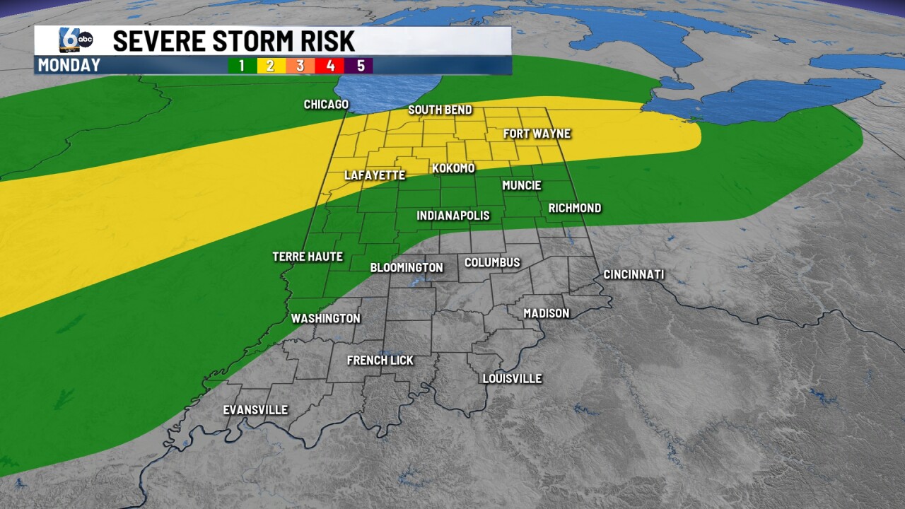

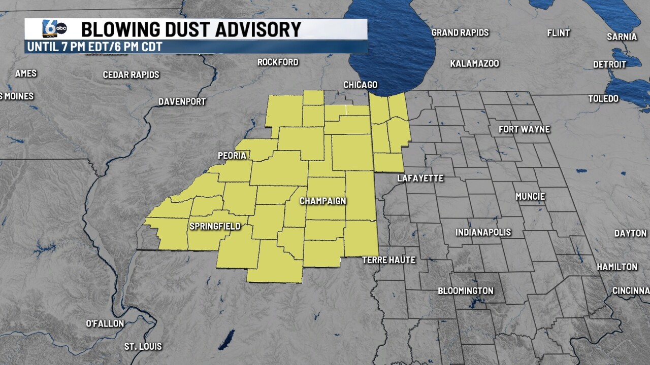
INDIANAPOLIS (WRTV) — Scattered showers continue to move through central Indiana this evening, along with winds gusting 30-40 mph. Some isolated spots of blowing dust have been reported in north-central Indiana. A Blowing Dust Advisory is in place for NW Indiana this evening.
TONIGHT
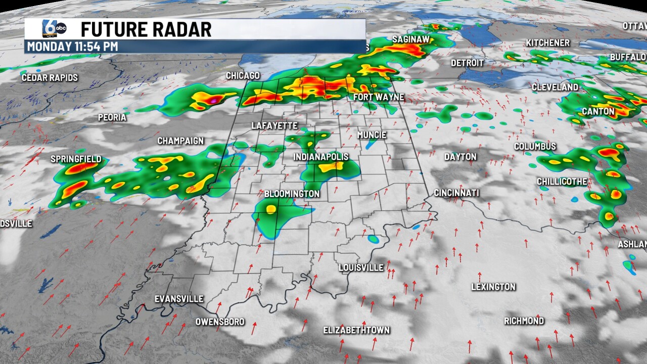
Scattered showers and storms. In Northern Indiana, a slight (2/5) risk of severe storms is in place for wind and hail. Temperatures will be back into the mid-50s by the early morning.

TOMORROW
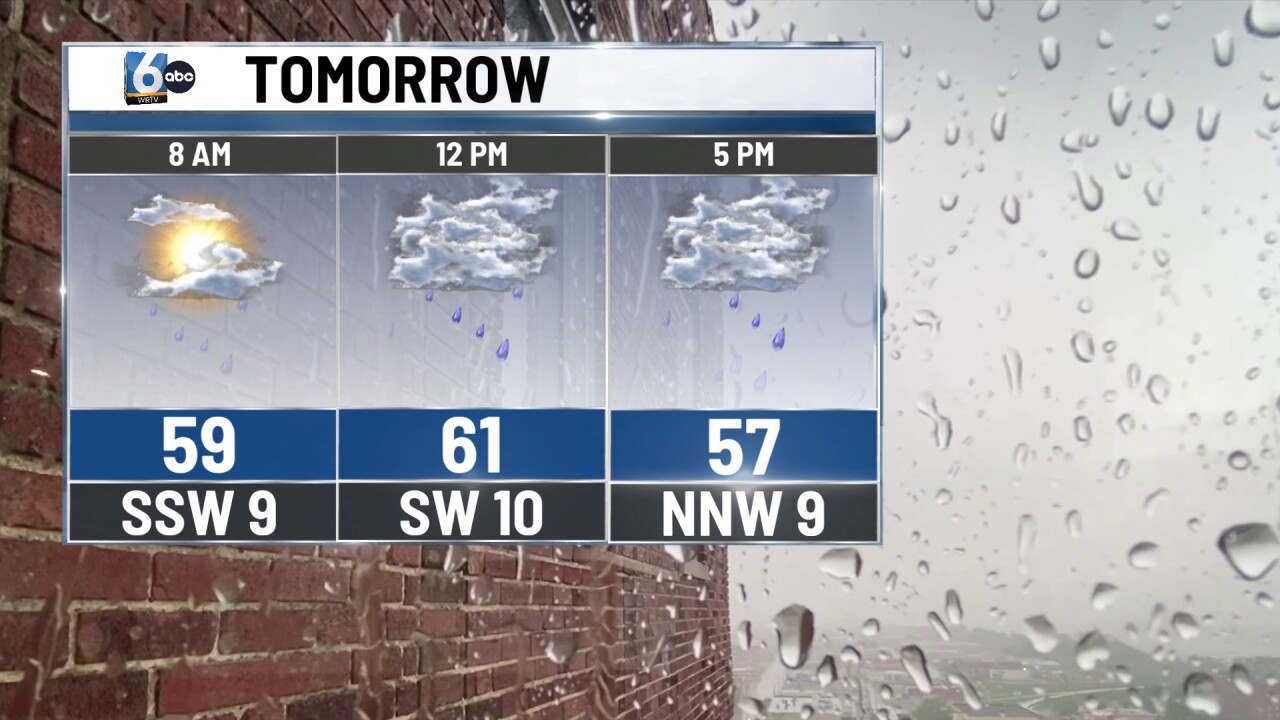
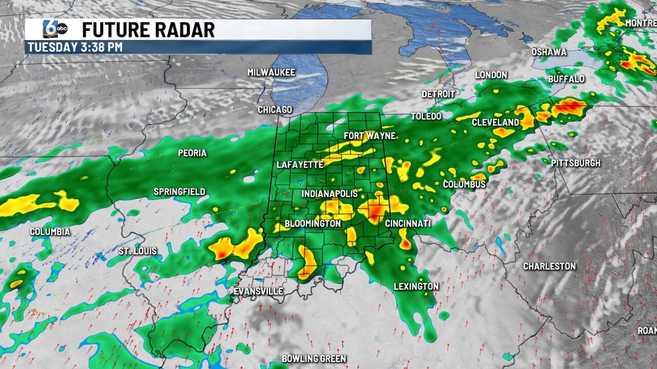
Showers and a few rumbles of thunder, especially in the PM hours. Rainfall amounts of 1-2" are expected from Monday night through early Wednesday morning. The bulk of the rain falls on Tuesday. Severe weather is not expected. High temperatures in the low to mid-60s.
WEDNESDAY
Scattered showers in the morning before central Indiana dries out. High temperatures will be cooler in the upper 50s.
7-DAY FORECAST

Temperatures will be below average to close out the work week. A couple of spotty showers are also possible on Friday, but not everyone is expected to get rain from this round. This weekend we will rebound into the 70s.
