


INDIANAPOLIS — A record warm April monthly low was potentially set in Indianapolis today at 70 degrees. If storms don't drop the temperature below 70 before midnight, this record warm low will stand.
TONIGHT

Spotty showers and storms in the evening. Any storms this evening would have an isolated damaging wind threat. The best chance at seeing any cells that meet severe criteria would be in north-central and northern Indiana. Scattered showers and storms are more likely late tonight into early tomorrow. Low temperatures in the low 60s.
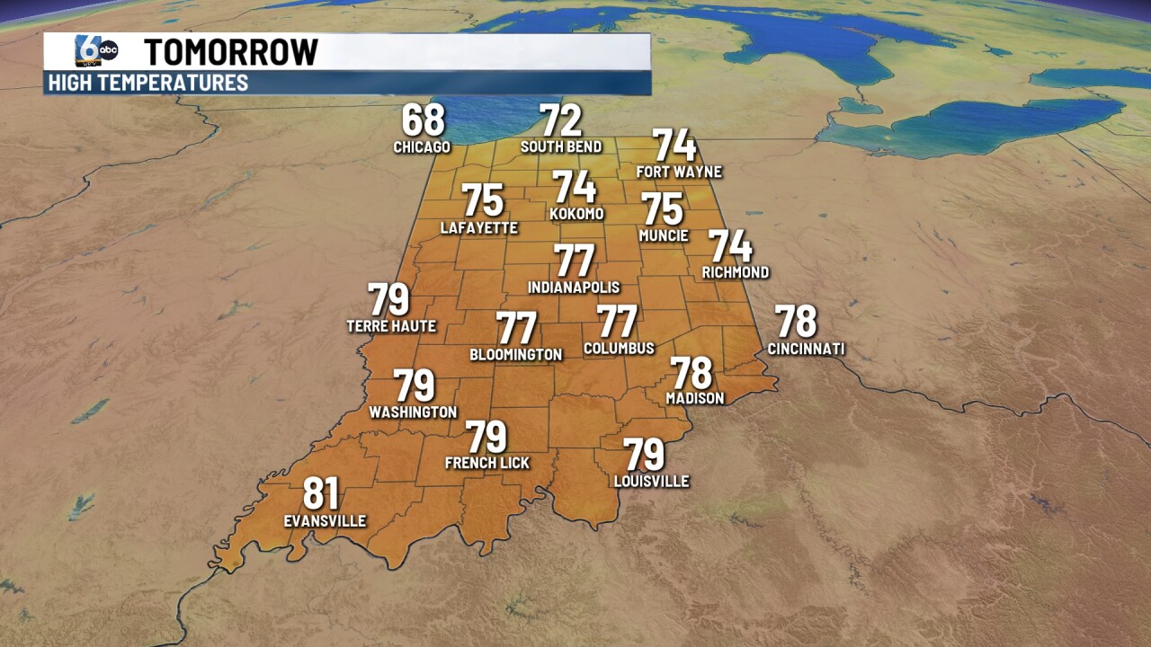
TOMORROW
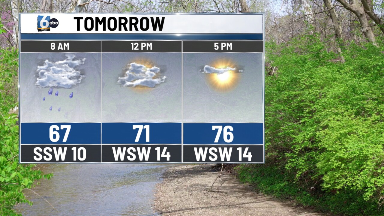
Scattered showers and storms as we wake up. Lots of dry time is anticipated after the fact through the afternoon and evening. A stray pop-up shower can't be ruled out, but the vast majority will not see that. High temperatures in the mid to upper 70s.
FRIDAY
Partly cloudy and warm. High temperatures in the low to mid 80s.
7-DAY FORECAST

Scattered showers and storms are anticipated Saturday morning into the midday hours. A slight risk of severe storms is in place for this timeframe. A strong cold front passes, and much cooler air works in Sunday/Monday. Low temperatures on Monday morning in the mid-30s.

