

INDIANAPOLIS (WRTV) - More clouds today with a few spotty showers. A wonderful weekend on tap with temperatures above normal. More unsettled weather with several rain chances and warmer temperatures heading into next week.
TODAY

Mainly cloudy conditions for much of the day today. Scattered showers and even a few rumbles of thunder possible on and off throughout the day today. The best chance of rain for the first part of the day will be in the northern part of Indiana. Spotty showers later this afternoon and into the evening are possible south of I 70. High temperatures will climb close to 70° in Indianapolis. Farther northward temperatures will stay into the low in the middle 60s. Winds will be a bit breezy at times and may gust to 20 mph.
TONIGHT
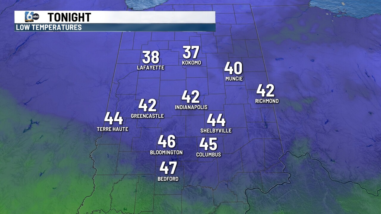
If you are heading to the Indianapolis Indians game or the Pacers game downtown much of the rain will be south of the city. Look for cloud cover and mild temperatures into the mid 60s. Overnight skies begin to clear and we will see temperatures fall into the 40s. Some spots in Northern Indiana will drop into the upper
TOMORROW
A chilly start on Saturday with readings into the 40s. We will see sunny skies on Saturday with high temperatures climbing into the upper 60s. The normal high for this time of the year is 62.
7 DAY EXTENDED FORECAST
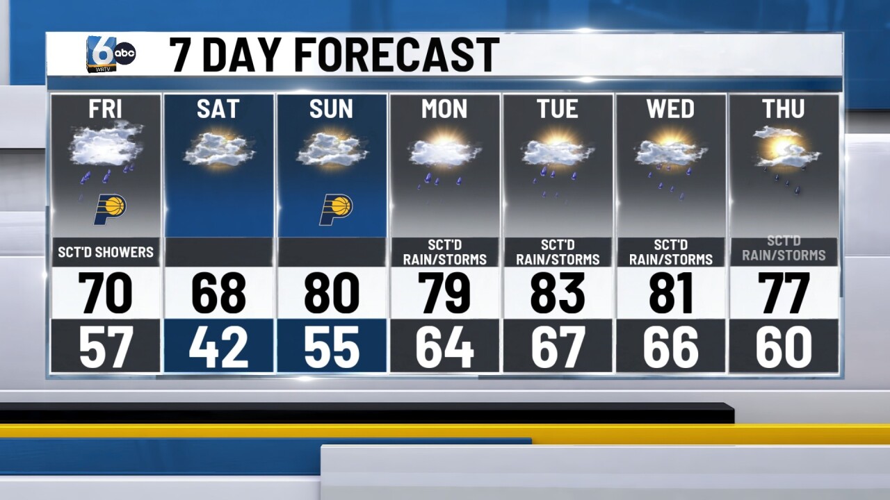
Clouds return on Sunday. It will be breezy with high temperatures, climbing close to 80.
An unsettled weather pattern will move into Indiana for much of next week. We will see several rounds of showers and even a few thunderstorms at times temperature. Temperatures will be above normal into the upper 70s and lower 80s. There is a chance on Tuesday that some of the thunderstorms could be on the stronger side across parts of Central and North Central Indiana.
