


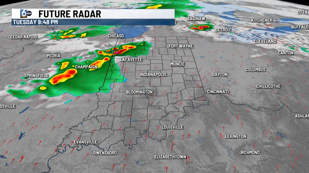
INDIANAPOLIS (WRTV) — A complex of storms is crossing northern Indiana early this evening, where a severe thunderstorm watch is in place. These storms will remain away from central Indiana.
TONIGHT

Partly to mostly cloudy. Record warm overnight low temperatures are possible. Lows in the mid to upper 60s. Indy's record warm low is 66 degrees, set back in 1883.
TOMORROW
Partly to mostly cloudy skies. Spotty midday showers/storms can't be ruled out. A slight (2/5) risk of severe storms is in place for Lafayette/Kokomo stretching into northern Indiana. This is for an additional round of storms that will fire up late in the day into the overnight hours. All modes of severe weather on the table. High temperatures in the low to mid 80s.

Indy's record high for April 14 is 85 degrees in 1883.

WEDNESDAY
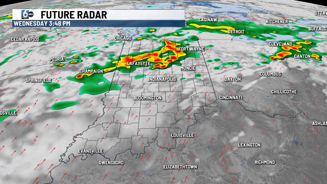
Scattered showers and storms, especially north of I-70. A marginal (1/5) risk of severe storms is in place mainly for the northern half of the state. High temperatures in the low 80s.
7-DAY FORECAST

Another round of showers and storms is anticipated on Thursday before a break in the action on Friday. The cold front finally arrives on Saturday, bringing more storms. Quieter weather moves in late weekend into early next week behind this front.
