


INDIANAPOLIS — A powerful cold front will sweep through the state this weekend, bringing a quick round of gusty winds, rain, lightning, and possibly an isolated spin-up. Behind the cold front, temperatures tank ushering in a fall feel with highs in the 60s!
The weekend forecast says it all. We will push near a record high temperature, landing around 82°. The record high is 84°. This will fuel storms and showers for Saturday evening into Sunday.

Our area is highlighted under a level 1 out of 5 risk for severe weather. That is a low end threat, but it is not zero. Most of us have the potential to see strong winds and even some flooding. We could get too much rain too fast on very dry ground. There are just enough ingredients to warrant a low end tornado risk. I want to stress this is certainly on the low end, but I want to make sure everyone has a way to get alerts, just in case! Know that we will be watching this system closely, and bring you updates as needed.

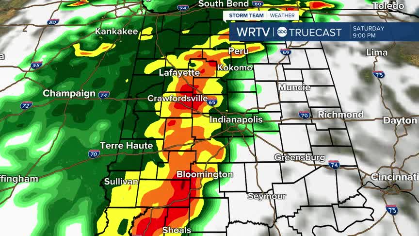
Below is one forecast models opinion on the weekend system. Most could start to see spotty storms and showers after 3pm. If you are going to the IU homecoming game - be weather aware. We are hopeful the storm will hold off until after the game. The lion's share of the storm will be here in the evening hours. This forecast model delays most of the storm until after dark (that will hopefully lower the severe potential). Even outside any thunderstorm this system could bring winds gusting up to 40+MPH. Make sure those fall/Halloween decorations are tied down!

As always, there is certainly no need to panic. This is a strong front, but the threats are conditional. Have a weather plan and stay tuned for updates on this weather maker. We end up with much more of a fall feel after this front clears. High temperatures next week land in the low to mid 60s with overnight lows in the 40s.
