
INDIANAPOLIS (WRTV) — Active weather, warm temperatures, and higher humidity values are all ahead this week.
TODAY
Breezy with isolated-scattered shower/isolated storm potential at times. Highs in the upper 70s. Winds will gust up to 25-35 MPH at times.
TONIGHT
Mostly cloudy and breezy. Record warm lows possible with the record in Indy being 66 from 1883.
TUESDAY
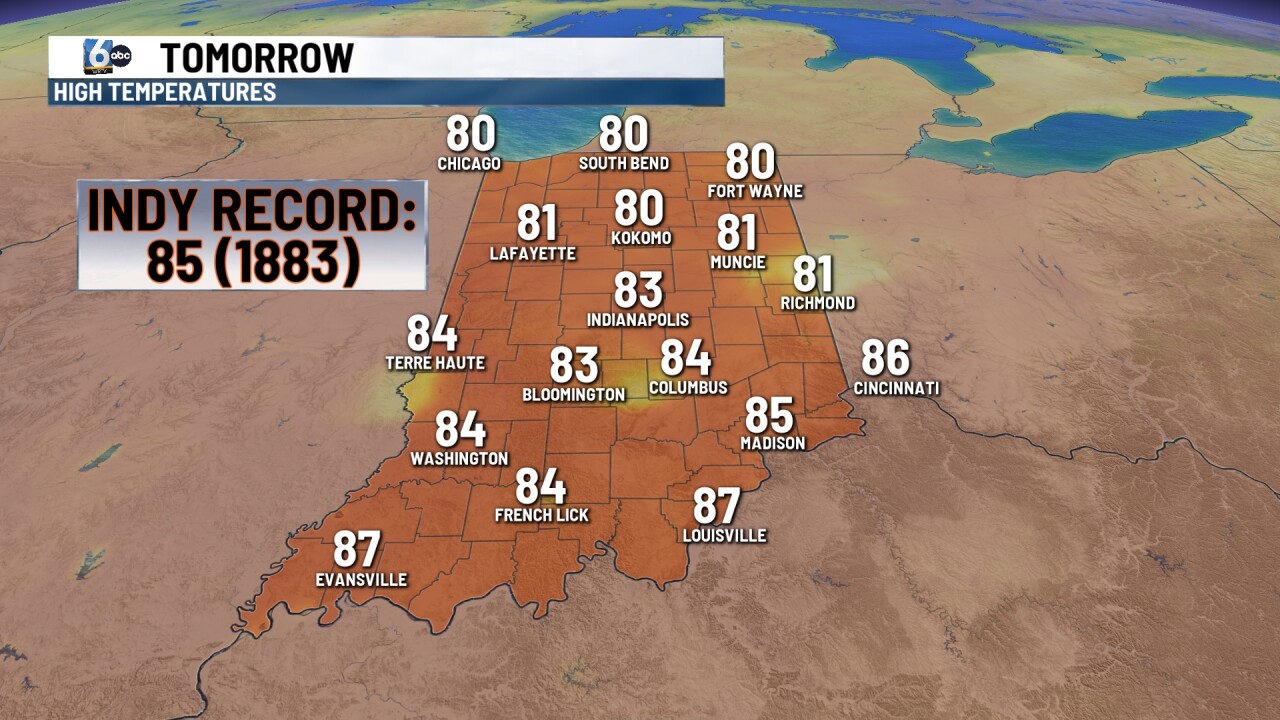
Record highs possible with a mix of sun and clouds. Indy's record high for Tuesday is 85 from 1883. It will also be breezy once again with gusts 25-35 MPH. Then, we'll track scattered showers-storms as early as potentially Tuesday afternoon. Additional development may slide into central Indiana Tuesday night-Wednesday morning.
There is a level 1/5 severe risk across a good chunk of central Indiana with a level 2/5 risk along and north of a Lafayette-Gas City line. Damaging wind and large hail are the primary threats.
WEDNESDAY
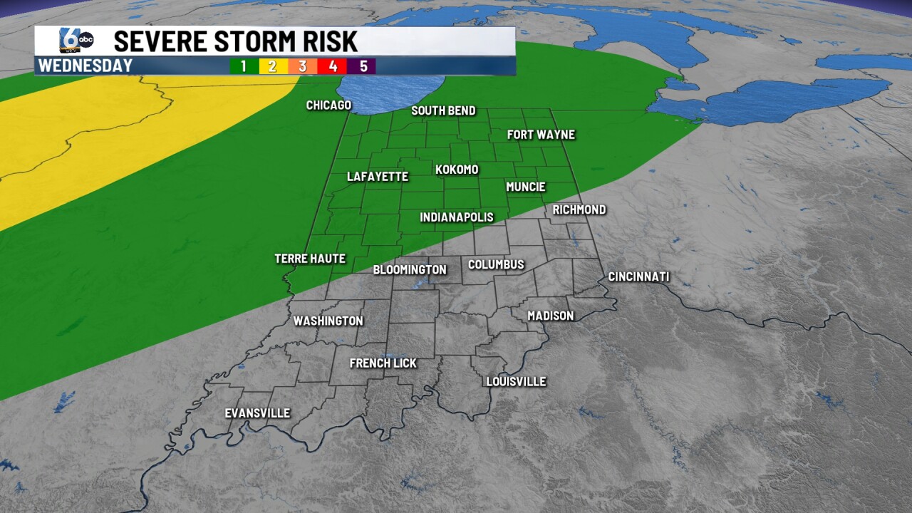
Showers and storms likely at times. There is a level 1/5 severe risk across northern and most of central Indiana with wind and hail the main concerns. Highs in the upper 70s to low 80s.
7-DAY FORECAST
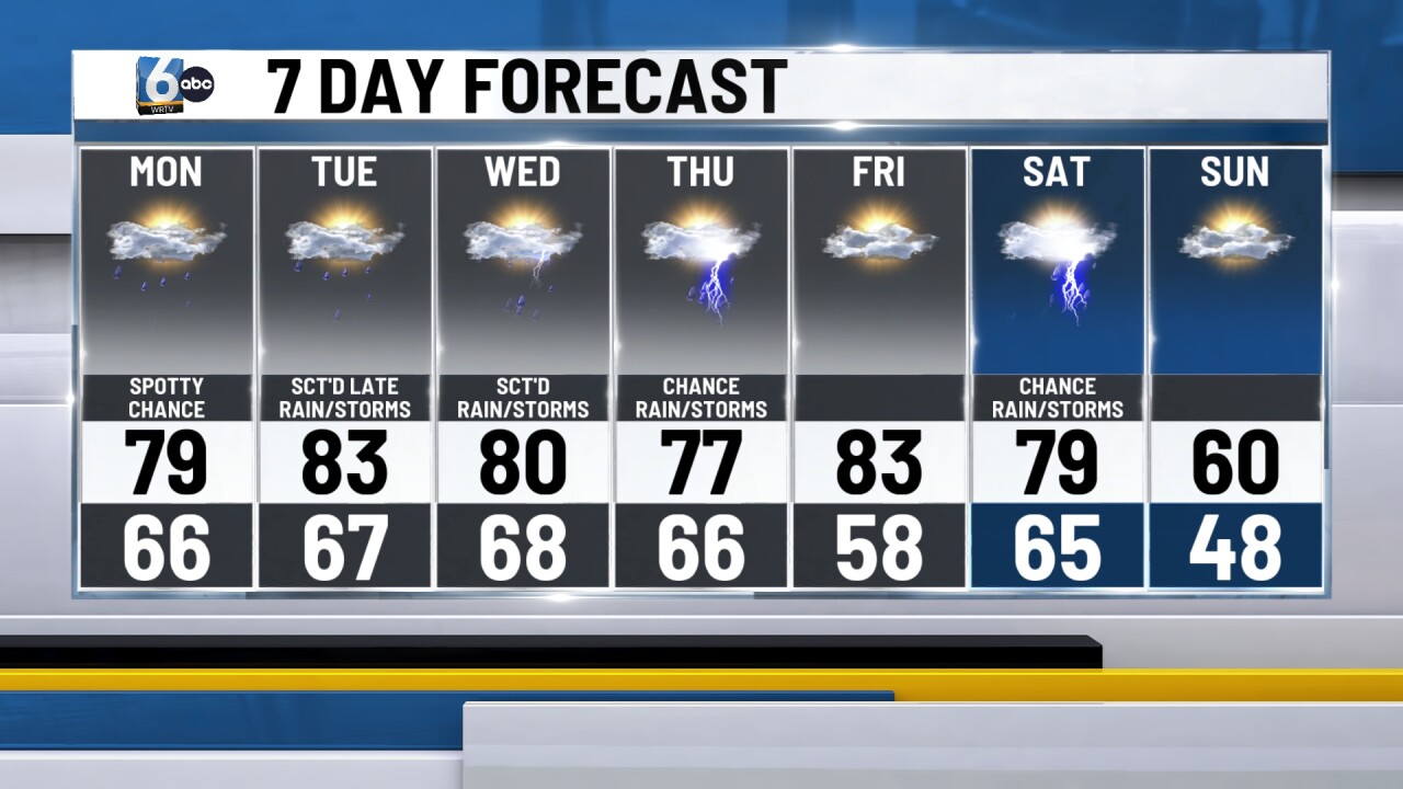
Showers/storms remain in the picture through Thursday before we end the workweek on a mostly dry note. Friday will be warm with highs pushing into the low to mid 80s. Saturday looks to feature a stronger cold front that will push through at some point in the day. Ahead of this front could feature a strong to severe storm risk if trends point toward a later frontal passage especially. Sunday will be much cooler with numbers in the lower 60s.
