

INDIANAPOLIS — The entire week in central Indiana has featured above-average temperatures. A strong cold front passes this weekend, knocking back our temperatures into the 30s by Monday morning.
TONIGHT

Mostly clear skies remain. Low temperatures drop into the mid-50s.
TOMORROW
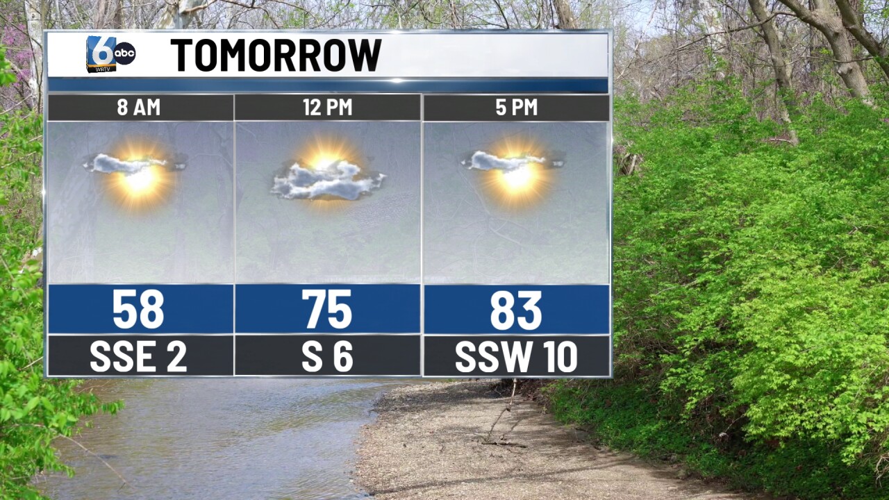
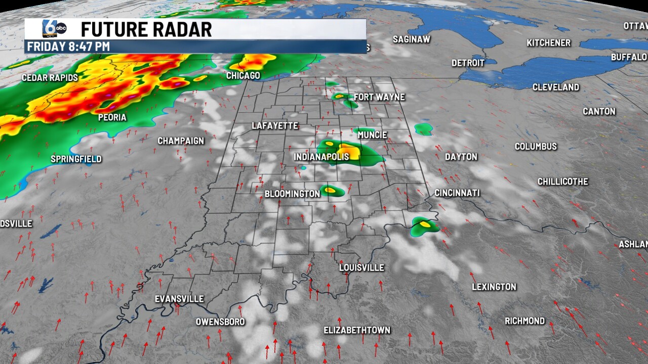
Partly cloudy & warm. High temperatures push into the mid-80s, which is just shy of a record high in Indy. Isolated showers and storms are possible in the evening, but more action will be on the way later on Friday night.
SATURDAY
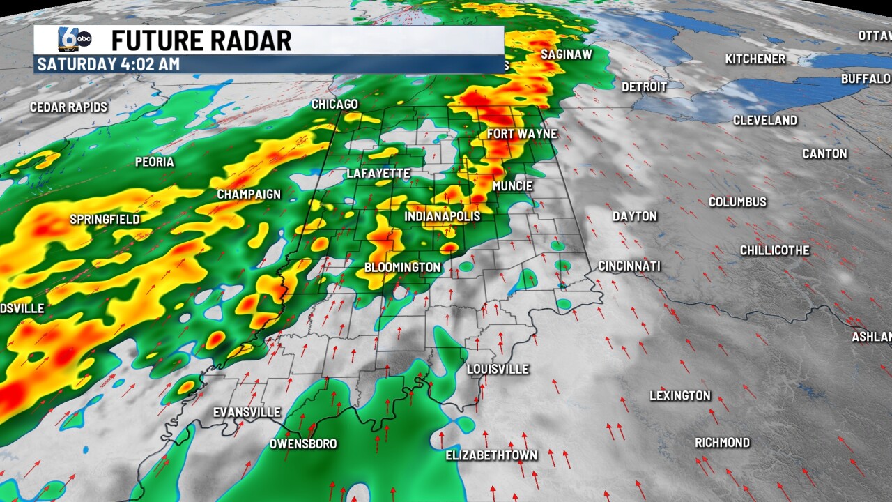
Showers and storms are likely in the morning hours along a cold front. A couple of gusty storms are possible with a low-end risk of severe weather. However, this line of storms will likely be weakening on its way through the state. Spotty PM showers are possible with clouds decreasing late. High temperatures in the low 70s.

7-DAY FORECAST

Colder and quieter works in for Sunday & Monday. A widespread frost is possible Monday morning with most spots waking up in the mid-30s. Temperatures climb into the 70s multiple times after Monday. Rain chances will be tough to come by with much of the forecast period dry after Saturday.

__
