

INDIANAPOLIS — We are keeping a close eye on our next snow chance for central Indiana. We could be waking up to several inches of snow Friday morning.
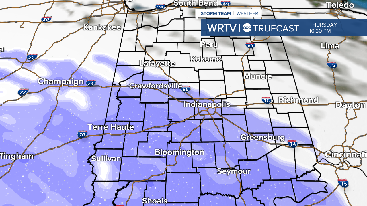
Our next winter weather maker is set to arrive here Thursday evening into Friday morning. We will likely start to see the snow fall after sunset Thursday. Here is a snapshot from one forecast model run for Thursday at 10:30 PM
This will continue overnight and taper off early Friday morning. Here is a look at 7 AM Friday morning.

The thinking, as of Wednesday morning, is the lion's share of the snow will target central and southern Indiana. This fast moving system will lay down a relatively narrow band of snow. That means there will be a sharp cutoff from those who see accumulating snow and those that this system completely misses. You will see that reflected in the snowfall forecast here.

It is looking likely that most of the WRTV viewing area will wake up to some snow Friday morning. I want to highlight the uncertainty with this system. If the center of this snow shifts north or south by even 50 miles, that will change who is most impacted. That means, we will have to tweak this forecast close to Thursday night to refine where the heaviest snow will fall. This is the first look and I would encourage you to be ready for a slippery Friday morning commute and please check back for updates.
