

INDIANAPOLIS (WRTV) - Warm and windy conditions for your Thursday. Temperatures continue to stay above normal for the next several days. Spotty rain chances Friday, but drying out for the weekend.
TODAY
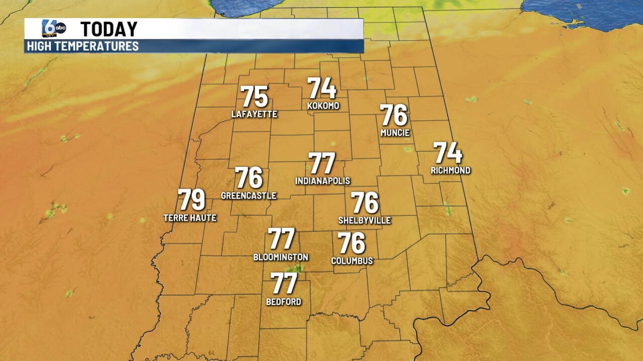
A mild morning will turn into a warm afternoon. Gusty winds out of the south and southwest may peak between 30 and 35 mph today. Those winds will help boost our temperatures well above normal for this time of year. High temperatures will climb near 77 degrees in Indianapolis. We will be partly cloudy with any rain chances staying well north of Indianapolis. There is an increased risk for fire danger thanks to not only the winds, but also the lower humidity values in place across much of the state. Limit burning outdoors during the afternoon.
TONIGHT

If you were heading to the Indianapolis Indians game tonight no weather worries for you at all. We will see temperatures into the 70s at first pitch with clear conditions. Overnight look for partly cloudy skies with temperatures falling into the mid 50s
TOMORROW

Another mild morning on your Friday, but we will see a few shower chances. On and off showers will be possible throughout the day. It doesn’t look like it will be a complete washout as there will be some dry time. High temperatures will be close to 70. Winds will be a bit breezy but not as gusty as yesterday. Winds may gust at times near 20 mph.
7 DAY EXTENDED FORECAST
Cooler conditions early Saturday morning with readings falling into the 40s. Temperatures will climb into the upper 60s with lots of sunshine on Saturday. On Sunday a little bit more cloud cover but temperatures will continue to rise close to 80 degrees for the afternoon.
More and settled conditions head into the state for much of next week. We will see several showers and even a few thunderstorms as well. High temperatures will be above normal into the upper 70s and lower 80s.
