
INDIANAPOLIS (WRTV) — The active, humid, and breezy pattern rolls on through late week with more record temperatures on the line.
TODAY
Prepare for another warm and breezy day with additional storm development getting back into the mix later this afternoon. Uncertainty revolves around where exactly in central Indiana we see this occur, but all eyes will be on radar starting 1-2 PM and onward into Wednesday night.
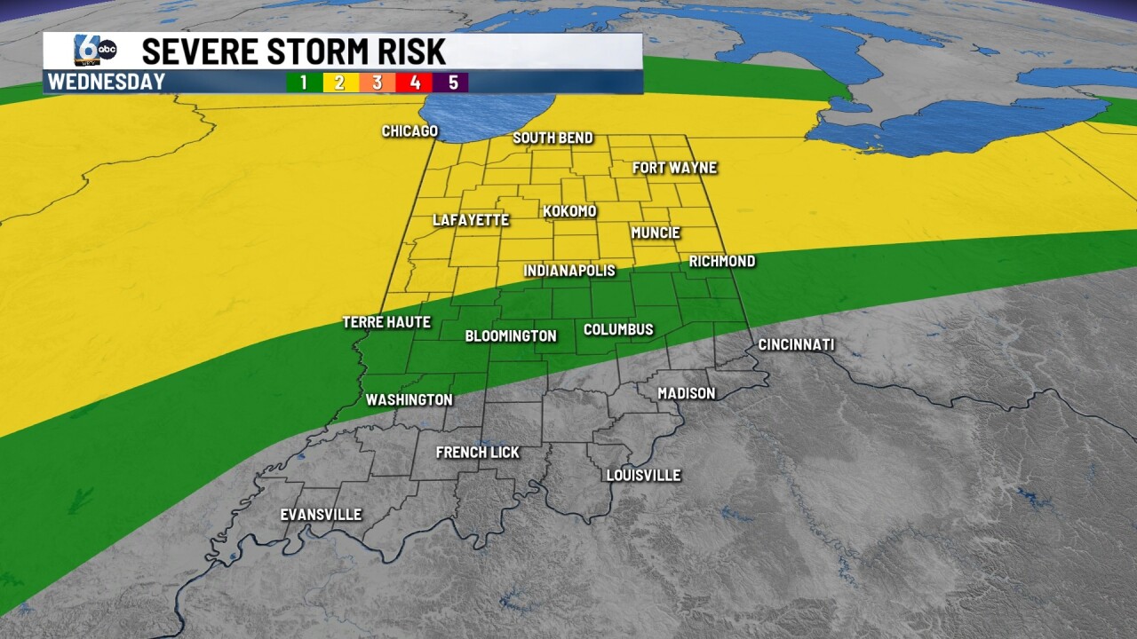
A level 2/5 severe risk near/north of I-70 is for Wednesday afternoon and night. Wind is the main threat, but isolated tornadoes and hail are also possible.
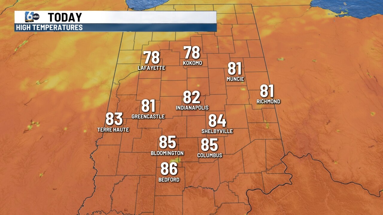
Highs in the low to mid 80s, and Indy's record high is 84 from 2002.
THURSDAY
Showers and storms likely, especially in the first half of the day. Highs in the mid to upper 70s and breezy.

FRIDAY
Warmer and mainly dry. Highs in the low to mid 80s.
7-DAY FORECAST

More showers and storms are likely ahead of a strong cold front Saturday. This will carry a risk for strong to severe storms. Sunday turns sharply cooler with highs plummeting into the mid to upper 50s. A frost risk may be in play Monday morning with morning lows kicking off in the mid to upper 30s.
