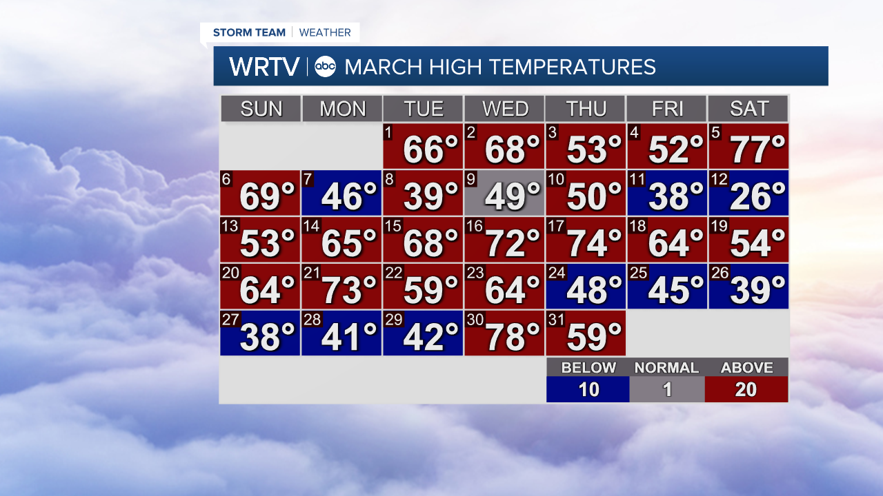
We're nearly two weeks into spring, and so far our temperatures have really kept us guessing on whether we need the shorts or the winter coat each day. Although March got off to a mild start, we've been running on the cool side lately.
As April gets underway, the overall cool trend continues. We're carving out what's called a weather trough in our upper-level winds. This translates to cooler and wetter weather for us. While our average high starts the month around 60 degrees, this unsettled weather will keep our highs near or below average over the next week to week and a half. The official April temperature outlook from the Climate Prediction Center places Indiana and surrounding states in "equal chances" of temperatures coming in near, below or above average. The aforementioned trough is forecast to exit the area relatively quickly. This means we should trend toward slightly above average temperatures the second half of the month. Our average high by the end of April is nearly 70 degrees.

April showers certainly look to be in our future. The trough keeps our weather active to start the month. We have a nearly daily chance for rain in the first seven days of April. This wet pattern is enough for the Climate Prediction Center to put us in above average chances for rainfall this month. When it comes to looking at rain chances the second half of the month, models are mixed on possible outcomes.

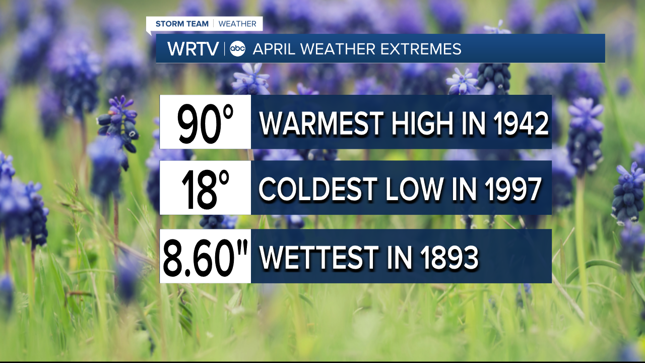
As with any month in central Indiana, April can bring us some extreme weather. Our temperatures have ranged as cold as 18 degrees to as warm as 90 in 1997. Spring storms can also bring us heavy rain and severe weather. That's why it's a good time to make sure you have the FREE Storm Shield app from WRTV. It acts like a weather radio and sends weather alerts right to your phone.