Central Indiana is under a Winter Storm Warning through Monday morning. Steady snow continues for much of our Sunday. However, the intensity should let up some during the afternoon with snow ending Sunday evening. Because of the very cold temperatures, road treatment is likely to be less effective than usual. This will keep travel impacts going into Monday morning.
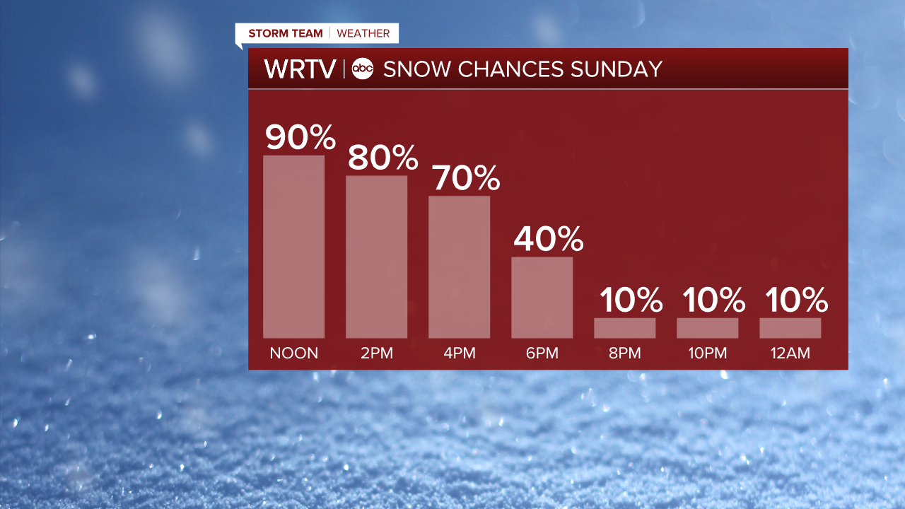
The very cold temperatures make this a light and fluffy snow. Wind gusts between 20 and 25 mph could hinder road crew efforts with some blowing and drifting of snow. Also keep the cold in mind as you work to clear the snow. Minimize your time outdoors. When you are outside, be sure to cover all exposed skin.

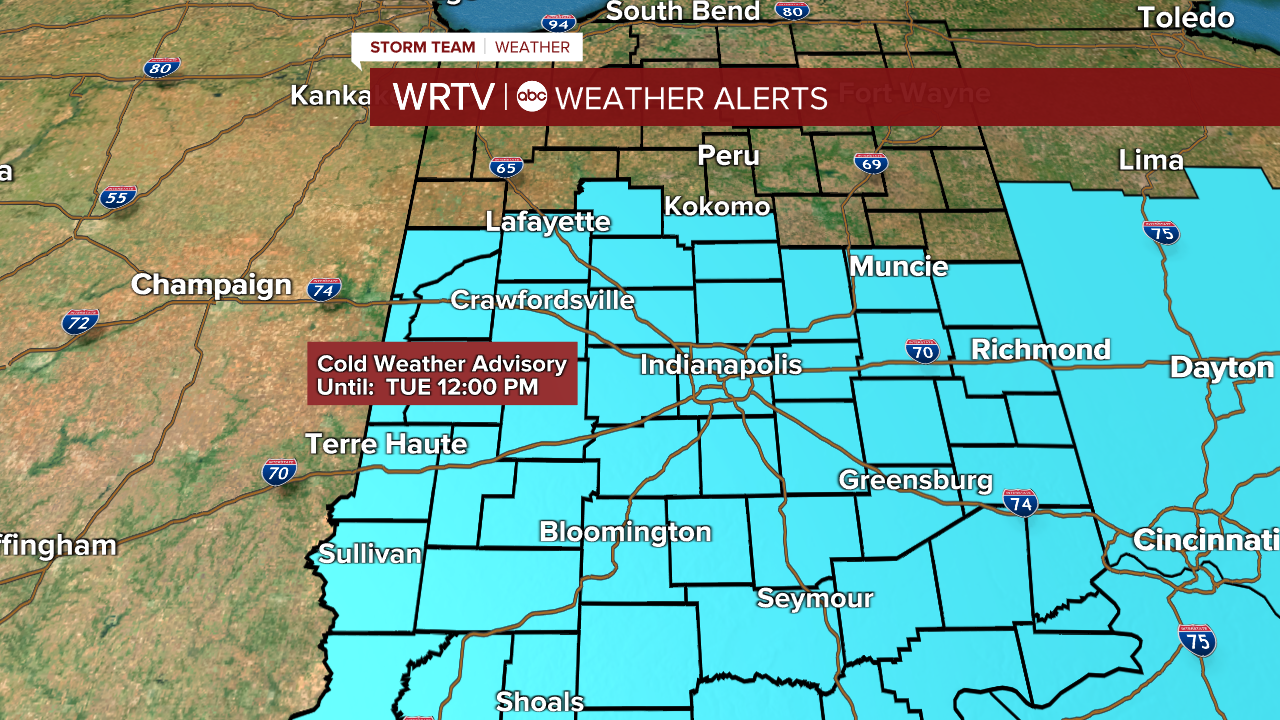
The brutally cold temperatures aren't going anywhere. The Cold Weather Advisory returns Monday night through noon Tuesday. During this time, wind chills are likely to drop around -15° to -20°.
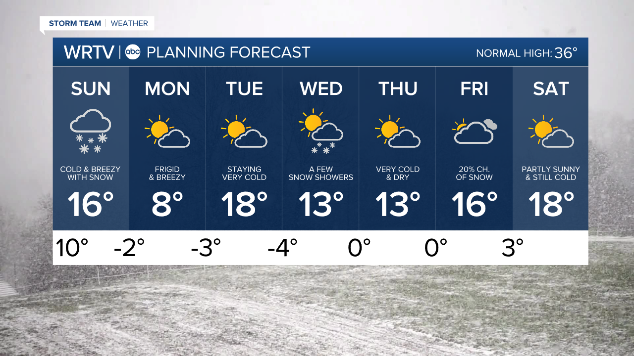
Indianapolis Weather Forecast:
Sunday: Heavy Snow. Snow tapers during the evening. High: 16°
Monday: Partly cloudy but still bitter cold. High: 8°
Tuesday: Partly sunny and very cold. High: 18°
Indianapolis 7-Day Weather Forecast