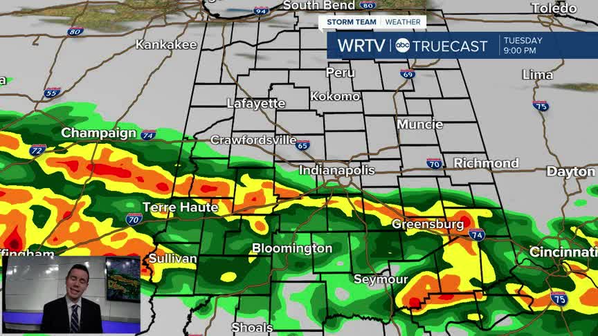


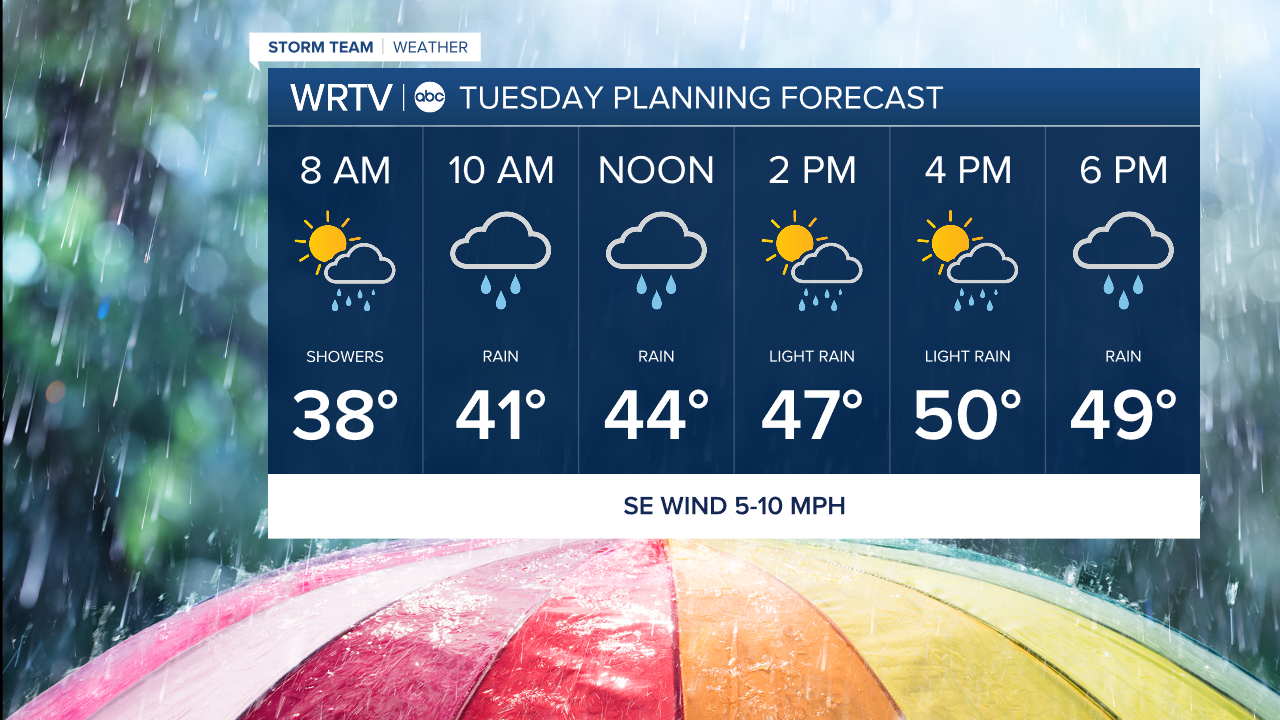
Outside of a few showers, the Tuesday morning drive should be pretty uneventful. However, it won't take long for rain to overspread Central Indiana through the rest of the morning. The afternoon brings a more scattered nature to the showers, before some heavy rain lines up across the area Tuesday evening into Tuesday night. No worries of any wintry weather with temperatures above freezing and highs in the lower 50s.
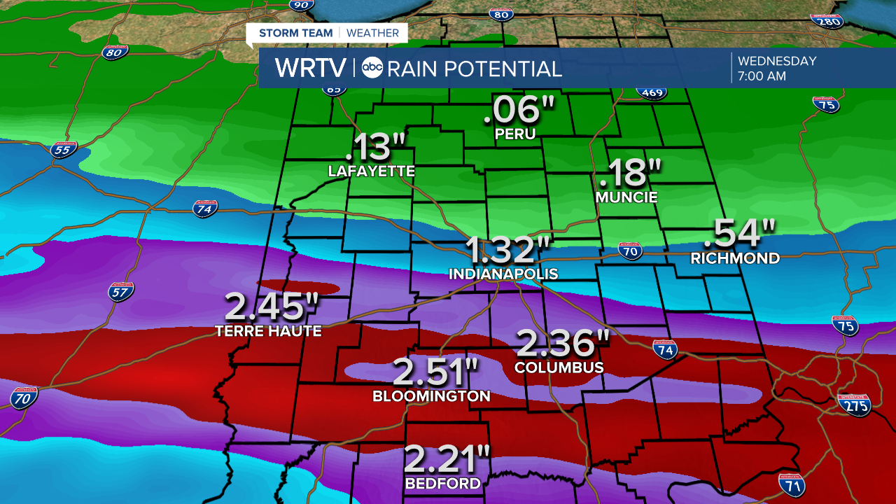
An area of heavy rain sets up near and south of I-70 Tuesday night. By early Wednesday, some areas could see more than 2" of rain. Some isolated flooding can't be ruled out. However, initially dry conditions should help minimize the threat.
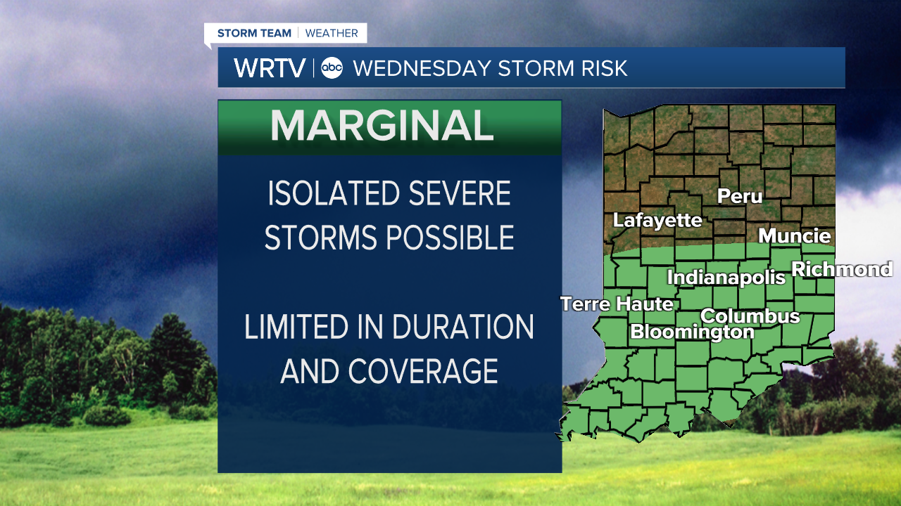
Rain becomes more scattered Wednesday, but we could also have a couple of strong to severe storms to keep an eye on.
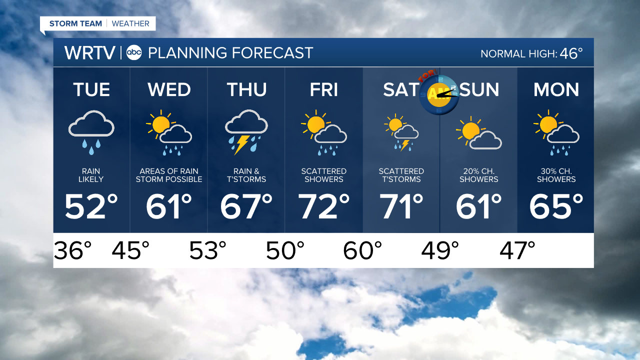
Indianapolis Weather Forecast:
Tuesday: Rain likely. Mostly cloudy. High: 52°
Wednesday: Areas of rain. T'storm possible. High: 61°
Thursday: Rain and t'storms. High: 67°
Indianapolis 7-Day Weather Forecast