


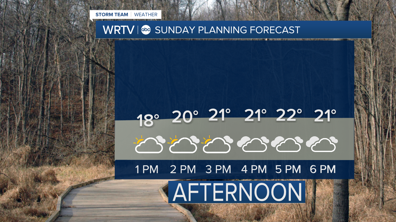
Sunday brings even colder temperatures to Central Indiana. Afternoon highs only make their way into the lower 20s, but it won't even feel that "warm". Wind gusts around 25 mph keep afternoon feels like temperatures in the single digits. Mostly cloudy skies continue to be the rule with just a little sun here or there. A few snow showers are possible Sunday evening. The best chance of seeing snowflakes will be across northern areas.
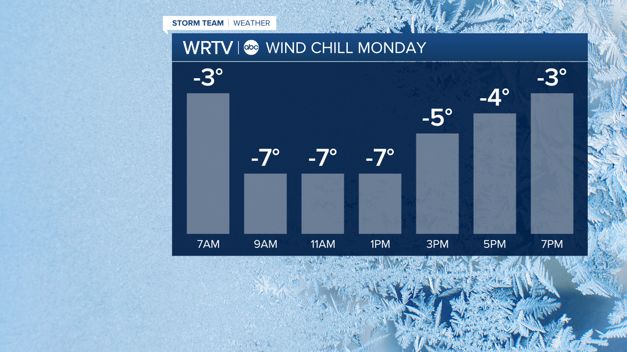
The core of the cold is with us Monday. If you can, it's a great day to stay inside. A breezy day results in wind chills below zero the entire day.
After that, we see temperatures slowly moderating some. Many of us should reach close to 40° by Wednesday.
Indianapolis Weather Forecast:
Sunday: Mostly cloudy. PM snow shower possible. High: 23°
Monday: Decreasing clouds. High: 15°
Tuesday: Partly sunny. High: 23°
Indianapolis 7-Day Weather Forecast

