


It's feeling more like the heart of winter as we still have about three weeks worth of fall to go.
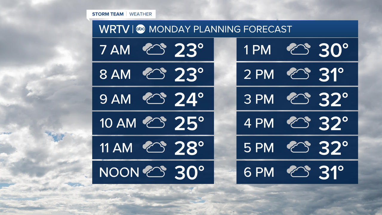
Monday is another gray and cold day across Central Indiana. Temperatures fall well short of average with highs only reaching around the freezing mark. An ESE wind at 5-10 mph won't add too much to the chill.
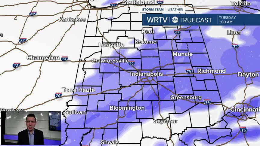
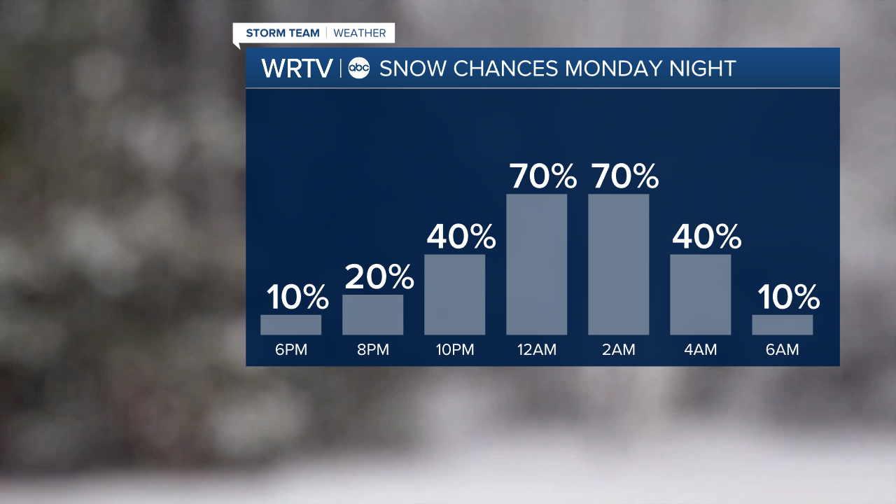
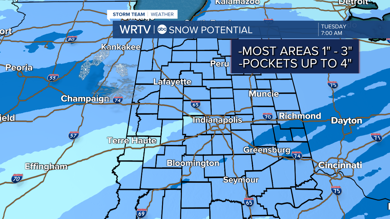
Our next weather system is already taking aim on the Hoosier State. Light snow may start to enter far NW areas during the evening drive, and will spread SE into Monday night. Snow should be winding down as we approach the Tuesday morning commute, but prepare for some slick conditions.
Right now, it looks like much of Central Indiana could see 1-3" of snow with some isolated totals closer to 4" also possible. Stay tuned for updates as we get more information.
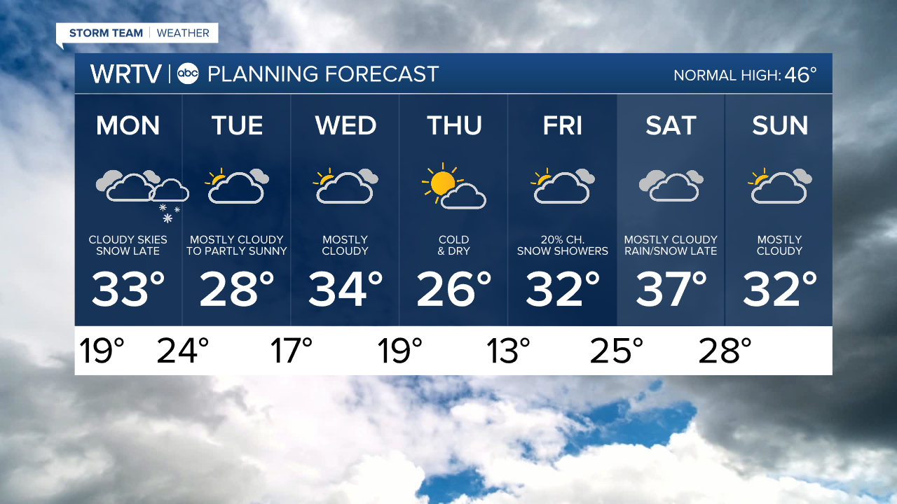
Indianapolis Weather Forecast:
Monday: Cloudy skies. Snow develops late. High: 33°
Monday Night: Light snow likely. Low: 24°
Tuesday: Mostly cloudy and cold. High: 28°
Wednesday: Mostly cloudy. High: 34°
Indianapolis 7-Day Weather Forecast