


Headlines
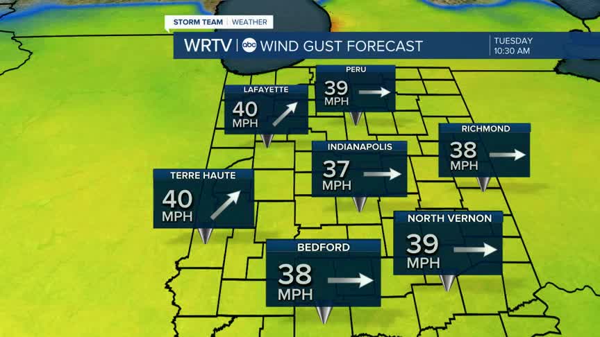
- WINDY TO START THE WEEK
- TUESDAY EVENING STORMS AND SHOWERS
- WET SECOND HALF OF THE WEEK
We are off to a warm start to the week. The trade off is dealing with stronger winds. Gusts will be as high as 40 miles per hour. Monday afternoon will land in the mid 70s under mostly cloudy skies. That is well above average for this time of year. It gets even warmer tomorrow. We expect the low 80s. The record high temperature is 85° so we likely fall short.

There is a chance for storms and showers Tuesday night into Wednesday morning. This comes with a low end risk a level 1 out of 5 for severe weather in some of our northern cities. We will be watching closely for any strong storms and we will be sure to bring you updates.

The second half of the forecast looks wet. Rain chances mark most of the week ahead starting Wednesday through the weekend. Easter Sunday features cooler temperatures and some scattered showers.
Indianapolis Weather Forecast:
Today: Breezy. High: 75°
Overnight: Partly cloudy. Low: 62°
Tomorrow: Warm with evening storms. High: 81°
Indianapolis 7-Day Weather Forecast

