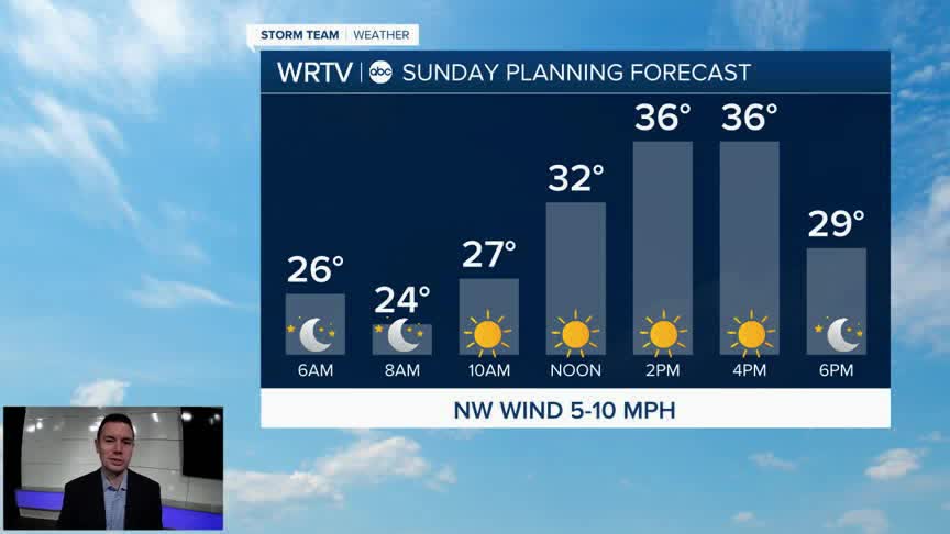


Sunday's drop in temperatures comes just in time for the official start of winter. Although it feels like it started weeks ago, the new season begins at 10:03am. Despite lots of sunshine, our high temperatures only manage to reach the middle 30s. Winds will be pretty light through the day. This means it won't feel much colder.

The holiday week brings a pretty substantial warming trend. Highs return to the 50s Tuesday and stay there for Christmas Eve. Christmas Day is likely to be one of our warmest on record with highs in the 60s. Outside of a few rain showers here and there, much of the week is quiet.

Indianapolis Weather Forecast:
Sunday: Mostly sunny. High: 36°
Monday: Mostly cloudy. Showers possible late. High: 46°
Tuesday: Mostly cloudy. High: 55°
Indianapolis 7-Day Weather Forecast

