


Headlines
- HUMIDITY START TO DROP OVERNIGHT
- MORNING CLOUDS TO AFTERNOON SUN WEDNESDAY
- NO MORE 90's FOR THE NEXT 7-14 DAYS.
You will wake to morning clouds and some drizzle across the area. Skies will then clear for lots of sunshine across the area with highs that will be in the lower 80s. A nice break from the heat. The humidity will also slowly decrease throughout the day.

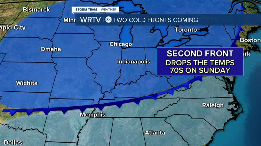
The end of the week will be beautiful, with temperatures in the 80s, low humidity, and plenty of sunshine. Late Saturday, another cold front will come through, which could bring an isolated shower as it passes.

By next week, we will have highs in the 70s and morning low temperatures in the 50s on Monday, with potentially the 40s for some on Tuesday.

Indianapolis Weather Forecast:
Overnight: Mostly cloudy. Some drizzle. Low: 69°
Wednesday: Morning clouds then clearing. High: 82°
Thursday: Mostly sunny. Lower humidity. High: 82°
Friday: Mostly sunny. High: 83°
Saturday: Mostly sunny. Spot pm shower. High: 85°
Indianapolis 7-Day Weather Forecast

