


Headlines
- ABOVE NORMAL THROUGH SATURDAY
- VERY COLD TEMPS SUNDAY AND MONDAY
- FIRST FLAKES OF THE SEASON FOR SOME
Thursday will be cooler than the past few days, but still very pleasant. Expect plenty of sunshine and highs in the upper 50s to low 60s.

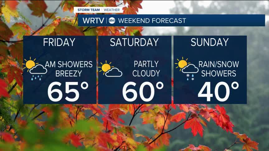
As we look ahead to the weekend, this is when the really big changes will start to occur. Friday will feature some scattered showers and maybe even a few rumbles of thunder. Temperatures, though, will still be well above normal, in the mid-60s. It will also be a bit breezy.
Saturday will be partly cloudy and remain in the 60s, but that evening a cold front will move through, bringing our first taste of winter. Highs on Sunday will likely occur just after midnight. After that, we’ll see temperatures tumble, with afternoon highs only around 40°.

Sunday morning will feature rain showers for most areas, but to the north, where temperatures will be a bit colder, some snow showers will also be possible. With the ground still warm, little to no accumulation is expected. Still, some of you may see your first flakes of the year.

Low temperatures on Monday and Tuesday will be in the 20s resulting in a hard freeze.
Indianapolis Weather Forecast:
Overnight: Mainly clear Low: 36°
Thursday: Mostly sunny. High: 59°
Friday: Sct. AM showers - Then some sun. Breezy. High: 65°
Saturday: Partly cloudy - Showers late. High: 60°
Sunday: Falling temps. Cold with rain/snow showers. High: 40°
Indianapolis 7-Day Weather Forecast

