


Headlines
- NEAR RECORD HIGH TEMPERATURES ON THURSDAY
- SEVERE STORM THREAT THURSDAY EVENING
- A SECOND SEVERE THREAT FRIDAY EVENING
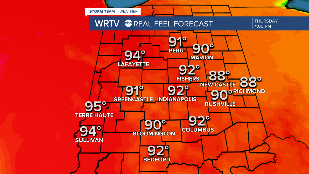
Thursday is a WRTV ALERT DAY for heat, humidity, and the severe storm threat. It will be the warmest day of the year so far, with high temperatures climbing into the upper 80s. The humidity will be high as well, making it feel like it's in the low 90s for much of the afternoon and early evening. Below are the real-feel temperatures at 4 PM.
During the evening hours, severe storms will be possible. Much of the area is under a slight risk of severe weather from the Storm Prediction Center. Wind and large hail will be the main threats, but a tornado cannot be completely ruled out.

There are many variables that still need to be worked out, as this is not a 'slam dunk' case of severe weather. Storms will be isolated, but any storms that do form are likely to be very strong. Stay with WRTV for the latest updates.

Another round of severe weather will be possible on Friday afternoon as well. In this case, the southern half of the area is under an 'Enhanced Risk' of severe weather.

Indianapolis Weather Forecast:
Overnight: A few showers & storms Low: 65°
Tomorrow: Hot & humid. PM Severe storm threat High: 88° (Record high is also 88°)
Friday: Partly cloudy. Severe threat again in the evening. High: 86°
Saturday: Partly cloudy. High: 76°
Sunday: Mostly sunny. High: 75°
Indianapolis 7-Day Weather Forecast

