


Headlines
- SOME SEVERE STORMS POSSIBLE OVERNIGHT
- FLOOD CONCERN FOR MORNING DRIVE
- TEMPERATURES FALL ALL DAY WEDNESDAY
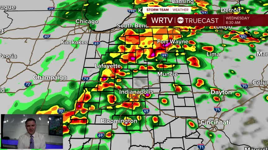
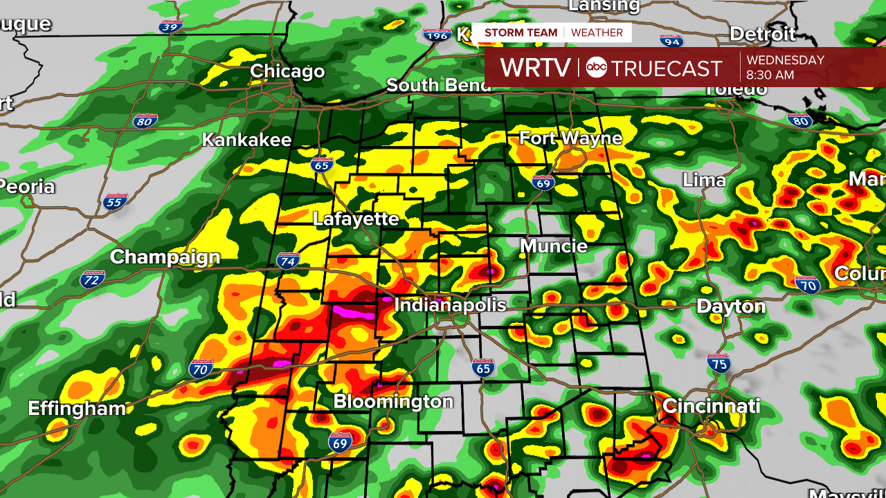
A line of storms will bring heavy rain as well as a wind, hail and isolated tornado through through the area as we get towards the morning commute. A quick spin up tornado isn't completely out of the question but for the most part it wind and hail would cause a few warnings. While it doesn't make a storm severe, heavy rain could lead to flooding and big issues for the morning drive.
WRTV
Once the rain ends and we start to clear out, temperatures will tumble.

WRTV
Indianapolis Weather Forecast:
Overnight: Storms sink south. Low: 64°
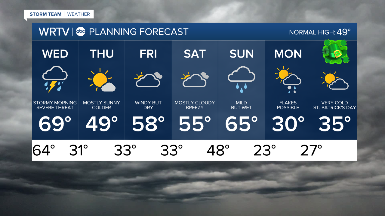
Tomorrow: Stormy morning. Then drying out. Temps fall. High: 69°
Thursday: Mostly sunny. High: 49°
Indianapolis 7-Day Weather Forecast
WRTV
