


Headlines
- GUSTY WINDS CONTINUE INTO THE OVERNIGHT
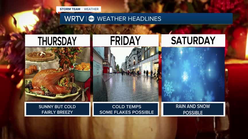
- A COLD BUT DRY THANKSGIVING
- SNOW TO A WINTRY MIX SATURDAY AND SUNDAY
Winter has made its presence known here across central Indiana, and it isn't going away any time soon. While it feels like winter now, it will start to look like it by the weekend, as a winter storm is expected to impact the area with rain and snow.
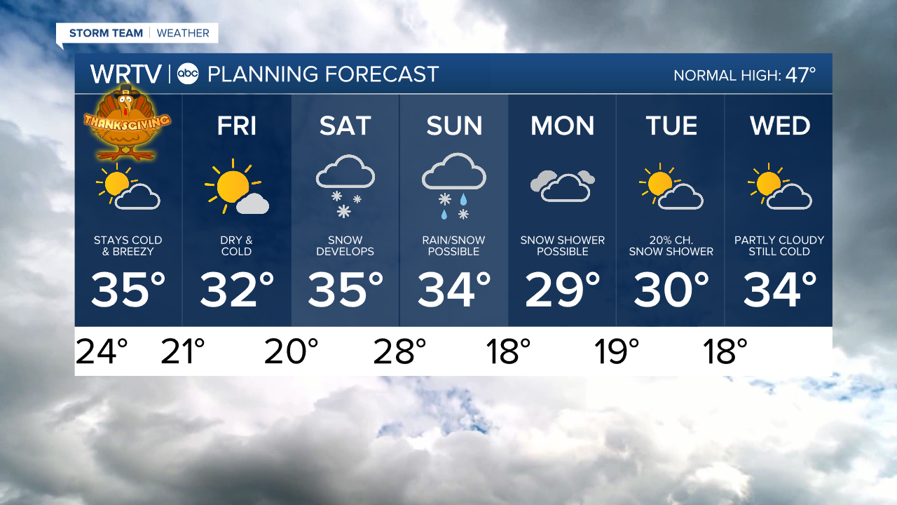
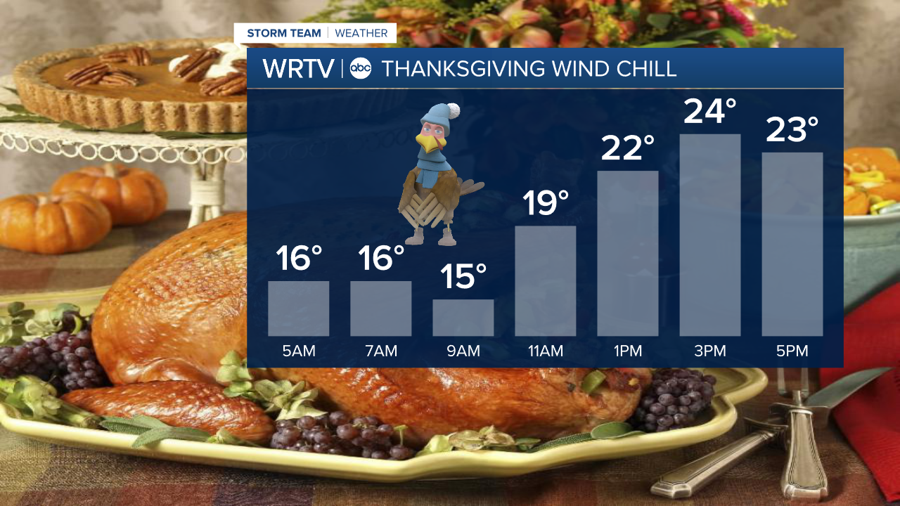
Thanksgiving Day will be quiet but very cold. Expect a high temperature that will struggle to get above the freezing mark in most locations.
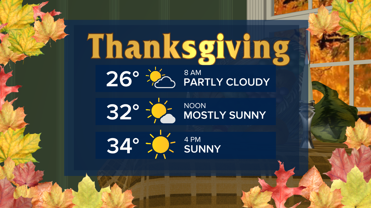
Factor in the wind, and it will feel like the temperatures are in the teens in the morning and only in the 20s during the afternoon hours.
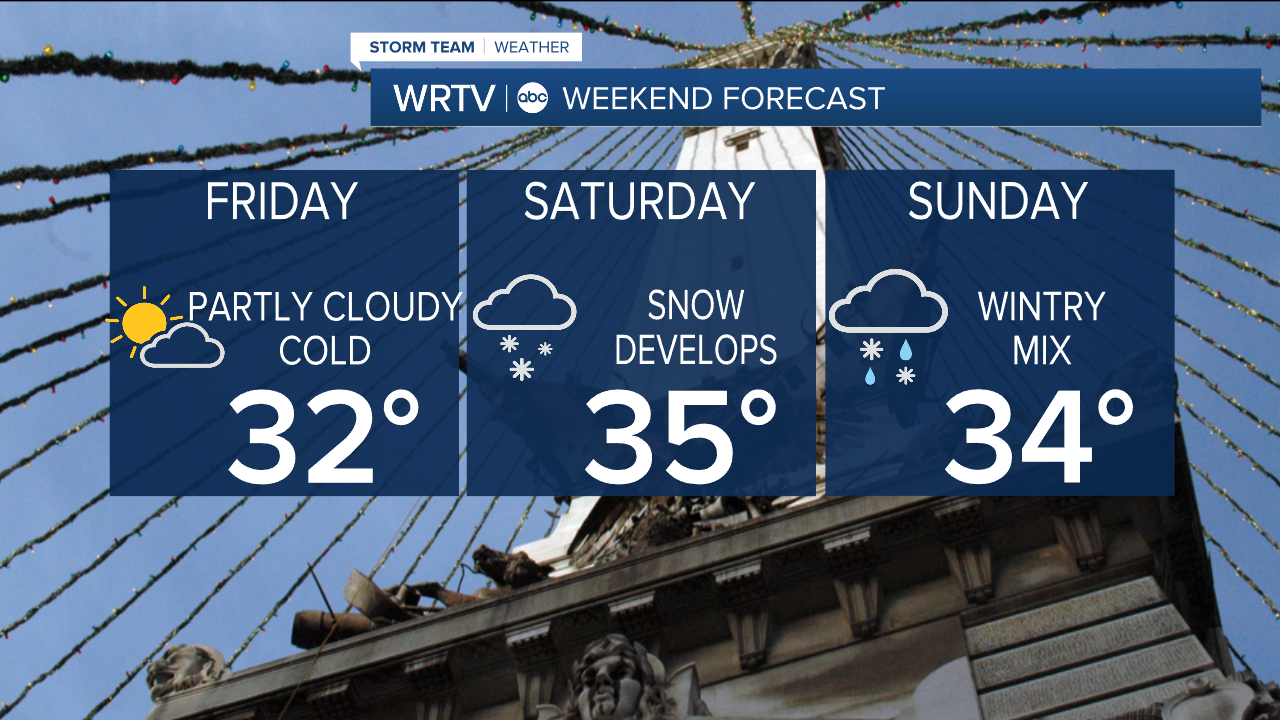
Friday will still be mainly quiet, with just a few snow showers to the north. However, on Saturday, a storm will bring the threat of some snow to the area before temperatures warm and it changes over to a wintry mix late Saturday into Sunday, eventually ending as snow once again.
Right now, it looks like several inches of snow could fall in northern locations, with an inch or two along I-70 before melting once temperatures warm and we change to rain. In southern locations, a brief accumulation will be possible before a quicker transition to all rain.

Models still vary enough that changes will likely happen as we get closer to the weekend.
Indianapolis Weather Forecast:
Overnight: Partly cloudy & windy. Low: 24°
Thursday: Partly cloudy - Cold. High: 35°
Friday: Partly cloudy. Cold. High: 32°
Saturday: Snow to wintry mix. High: 35°
Sunday: Wintry Mix. High: 34°
Indianapolis 7-Day Weather Forecast