


Headlines
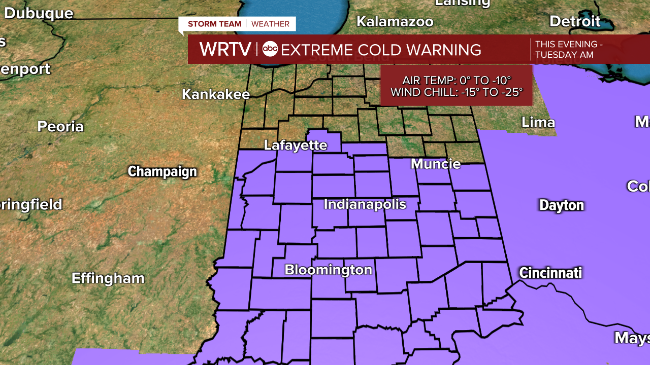
- EXTREME COLD WARNING OVERNIGHT
- WEDNESDAY MORNING IS THE COLDEST
- COLD BUT QUIET WEEK OF WEATHER
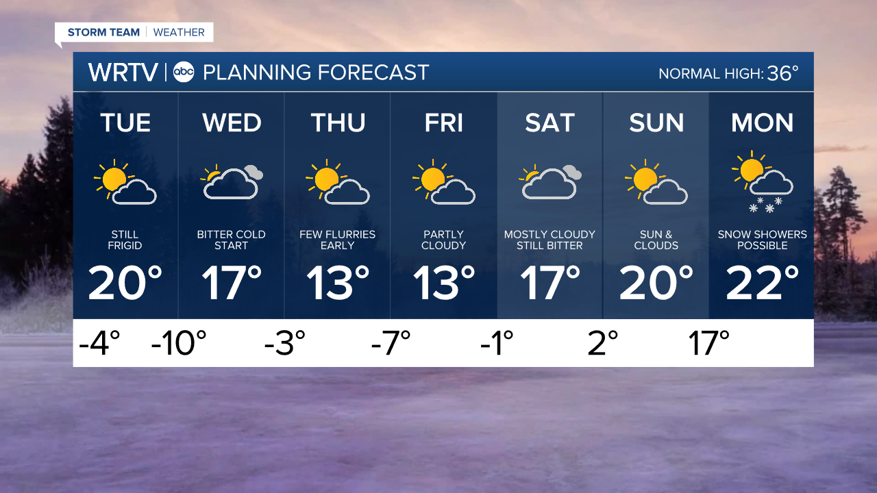
Now that our storm is in the rearview mirror, our focus each day will be on the bitter cold air that isn’t going anywhere anytime soon. Each day this week, we will be below zero in most locations until we get to Sunday morning. No significant relief will begin until next week. These temperatures might vary slightly, as any high, thin cloud cover could keep you above zero. However, where clear skies are present, combined with the arctic air mass and snow on the ground, temperatures will easily drop below zero.
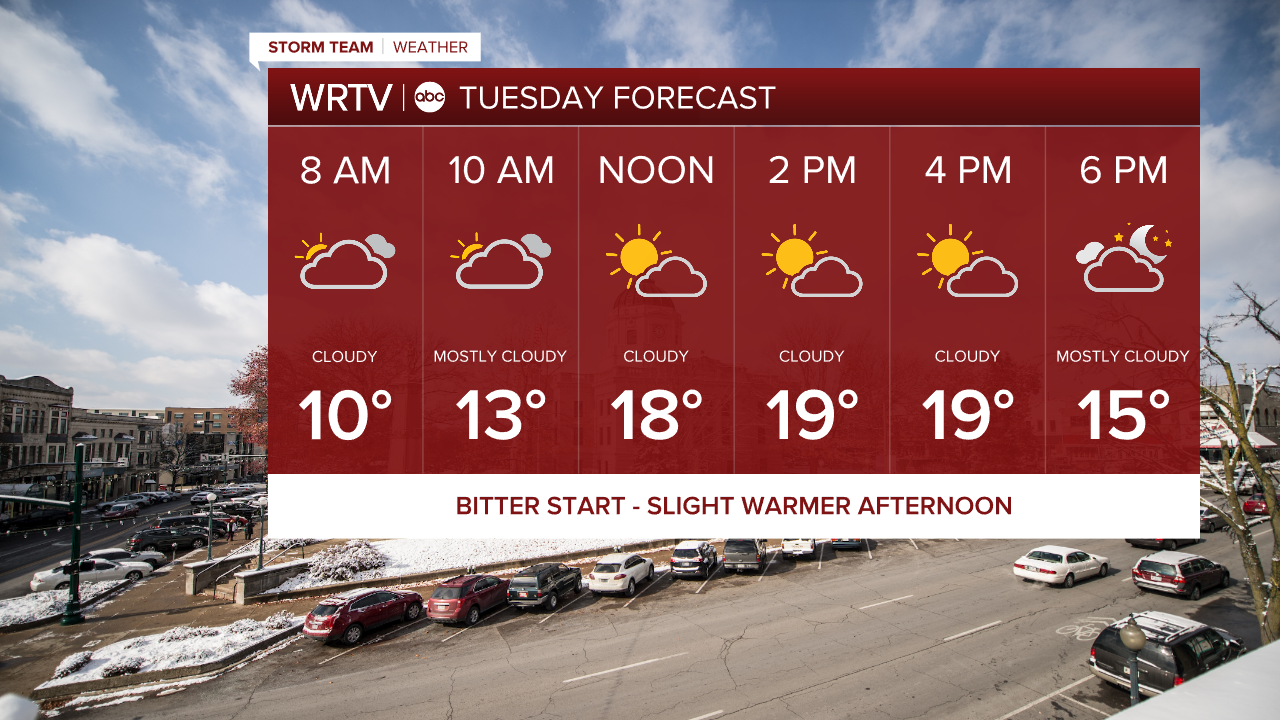
The Extreme Cold Warning is in place overnight. Temperatures will actually rise a bit overnight after reaching their lowest point around midnight or shortly after. By the time you wake up, temperatures will be in the single digits, then warm up to near 20° during the afternoon hours.
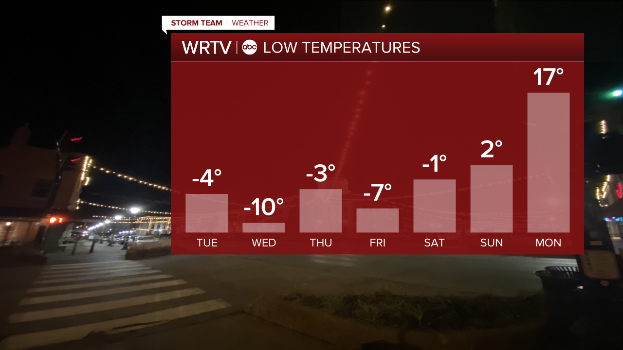
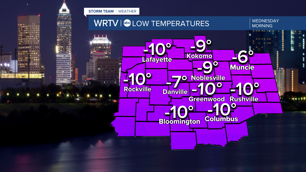
The coldest morning of the entire week will be Wednesday. Temperatures could drop to as low as -10° or even a bit colder in some areas. After that, temperatures will gradually begin to moderate once again.
While there could be a few flurries at times in this very cold air, we aren't expecting any major storms this week in central Indiana. However, a large southern storm moving up the East Coast is possible if you are traveling in that direction.
Indianapolis Weather Forecast:
Overnight: Partly cloudy. Temps slowly rise Low: -4°
Tuesday: Partly cloudy High: 20°
Wednesday: Mostly cloudy. Flurries late. Low: -10° High: 17°
Thursday: Partly cloudy. Low: -3° High: 13°
Indianapolis 7-Day Weather Forecast