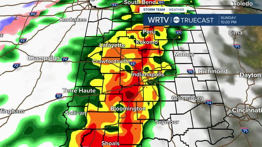


Sunday evening, a line of strong to severe thunderstorms will push across Central Indiana. The primary impacts are damaging wind gusts and possibly a tornado.
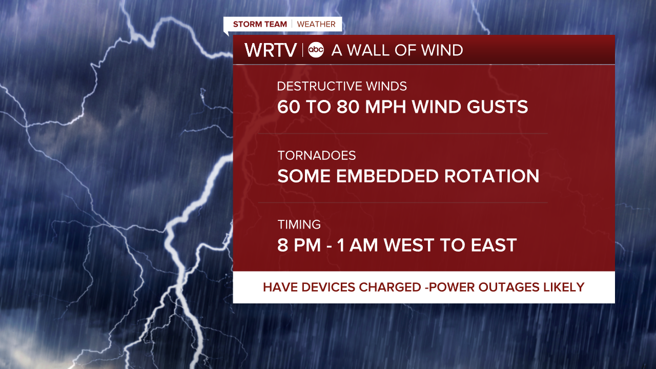
The line will approach the Illinois / Indiana state line around 8 p.m., then continue to push east across Indiana.
We expect it to approach the Indy area around 10 p.m. and get into eastern areas around midnight. There is an Enhanced Risk (Level 3/5) covering areas around Indy and to the SW. A Slight Risk (Level 2/5) covers the rest of the state.

As the high wind warning expires after the storms, a wind advisory stays in place until 8 a.m. Monday. This will push much colder air into the state.
Temperatures turn sharply colder overnight. By Monday morning, we'll find temperatures falling into the 20s. Scattered snow showers could bring some light accumulations and slick spots. Winds stay gusty, which will bring wind chills in the teens.

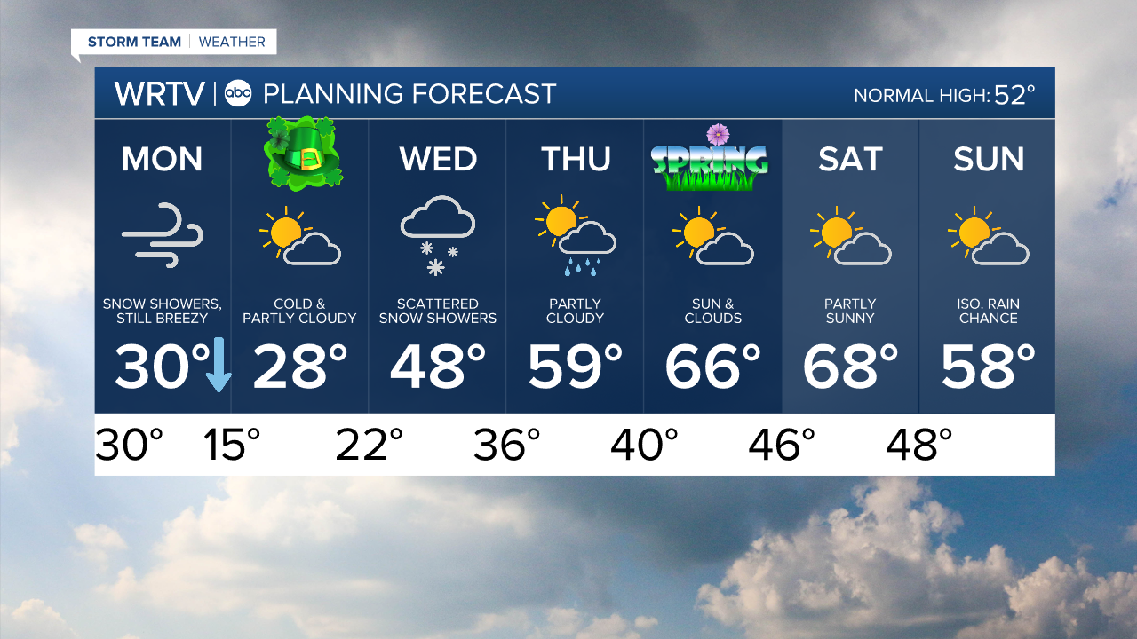
Indianapolis Weather Forecast:
Sunday: Mostly cloudy and windy. Storms late. High: 72°
Monday: Cloudy and breezy with scattered snow showers. Temps fall into the 20s.
Tuesday: Partly sunny and cold. High: 30°
Indianapolis 7-Day Weather Forecast