


Headlines
- TUESDAY IS THE PICK OF THE WEEK
- NUMEROUS RAIN CHANCES AFTER TUESDAY
- LOCALLY HEAVY RAIN THE MAIN THREAT
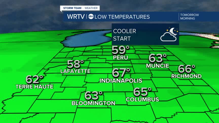
Overnight temperatures will fall into the upper 50s in the north, while southern locations will experience lows in the low to mid 60s.

Tuesday will be the best weather day of the week, with partly cloudy skies and temperatures ranging from the mid to upper 80s. The daytime hours will remain dry; however, some storm chances are expected to enter the forecast late in the evening.

Once we get to Wednesday, storms will become more numerous, and each day there will be a threat of heavy downpours extending into the weekend. The overall severe weather threat appears fairly low; however, a couple of storms could produce warnings for gusty winds. The primary concern, though, will be locally heavy rain.
Indianapolis Weather Forecast:
Overnight: Mainly clear. Patchy fog possible Low: 67°
Tuesday: Sun & clouds. Warm High: 88°
Wednesday: Numerous showers & storms. High: 86°
Thursday: Sct. showers & storms. High: 87°
Indianapolis 7-Day Weather Forecast

