

Headlines
- ANOTHER ROUND OF LIGHT SNOW TUESDAY
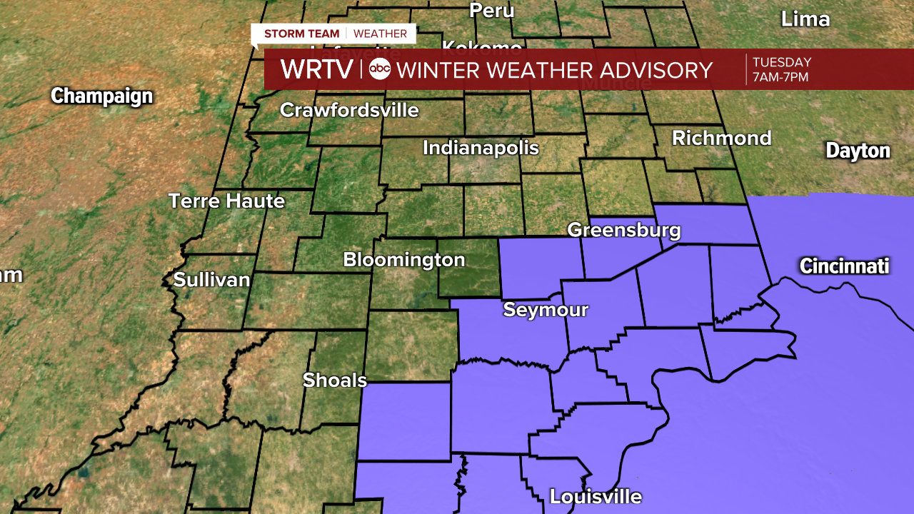
- WINTER WEATHER ADVISORY SOUTHEAST
- 2" OR LESS OF ACCUMULATION
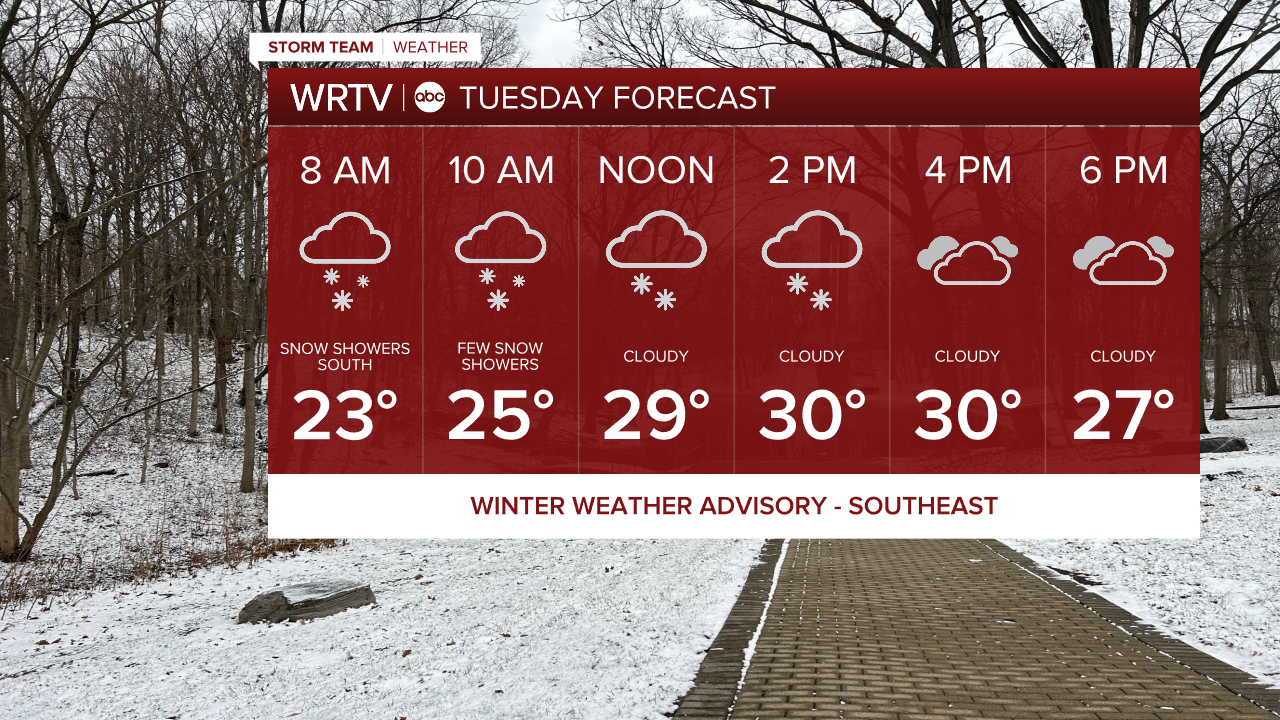
Another round of light snow will develop and move through the area primarily tomorrow morning before tapering off in the afternoon. Not everyone will see accumulation; the further north of Indy you are, the less likely you are to see any accumulation. This will mainly be a southern storm as the low-pressure area passes through northern Kentucky. Several southeast counties are under a Winter Weather Advisory from 7 a.m. to 7 p.m. It will be a fairly thin band of snow that could quickly put down a couple of inches. North of that band, a few snow showers will be likely. Any snow that does fall will stick and could create slick conditions for the morning commute.
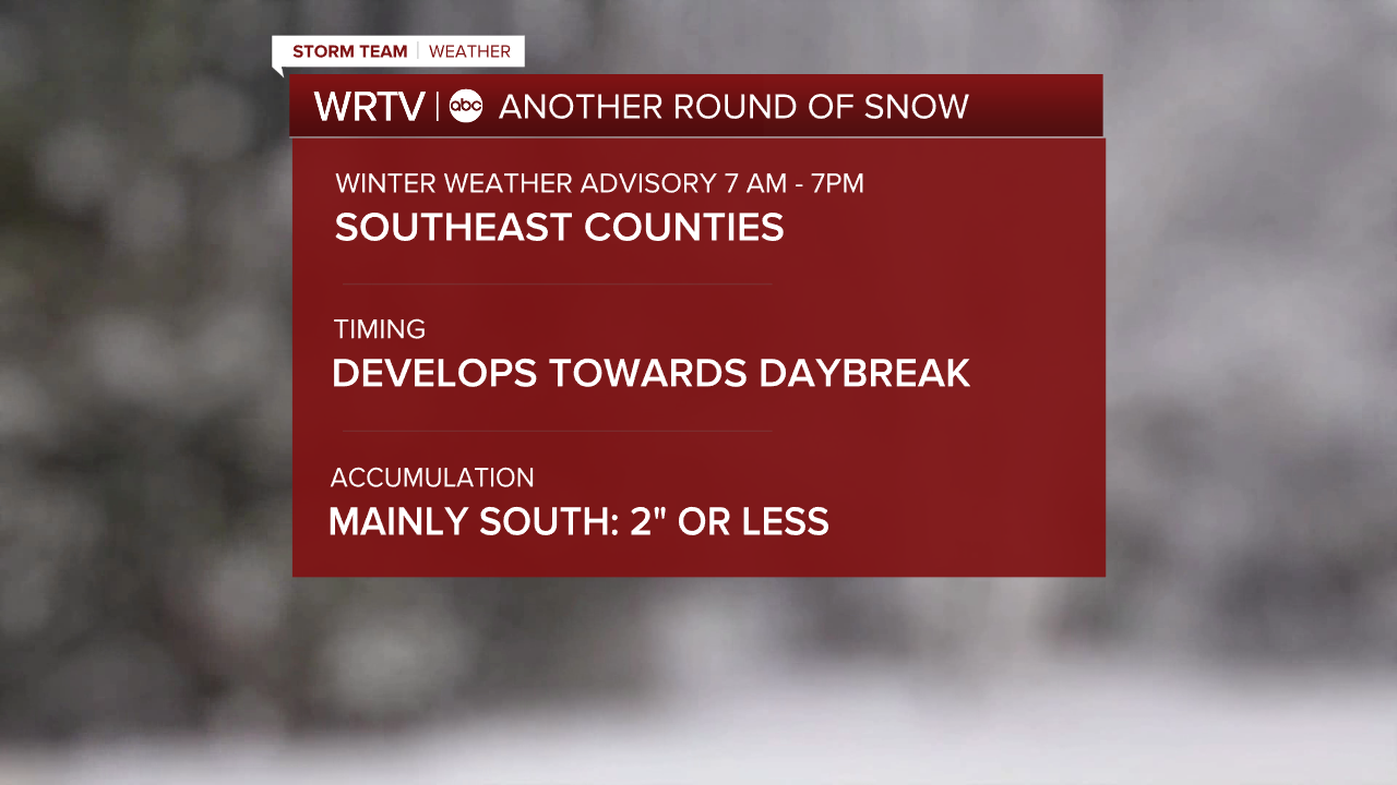
The highest totals will be from Seymour to Greensburg and points south and east. From there, totals will drop off to the north and west. For the metro area, a coating is possible but you shouldn't see much more than that. For those of you north of Indy, I wouldn't expect much more than some flurries or snow showers.

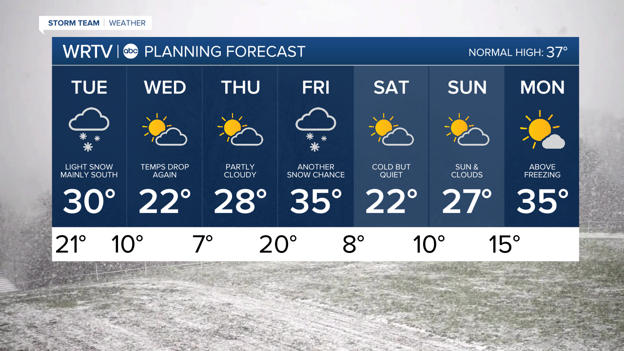
Temperatures will climb to near 30° in the afternoon. Behind this system, we will again see temperatures fall back into the upper 20s for Wednesday's highs.
Another snow chance arrives on Friday. This again looks to be a weaker storm, with the best potential in northern locations. There are some signs of a pattern shift next week that could bring us back above normal and out of the deep freeze.
Indianapolis Weather Forecast:
Overnight: Cloudy Low: 21°
Tuesday: Light morning snow then cloudy High: 30°
Wednesday: Mostly sunny. High: 22°
Thursday: Partly cloudy. High: 28°
Friday: Light snow possible. High: 35°
Indianapolis 7-Day Weather Forecast