


Headlines
- ANOTHER ROUND OF LIGHT SNOW OVERNIGHT
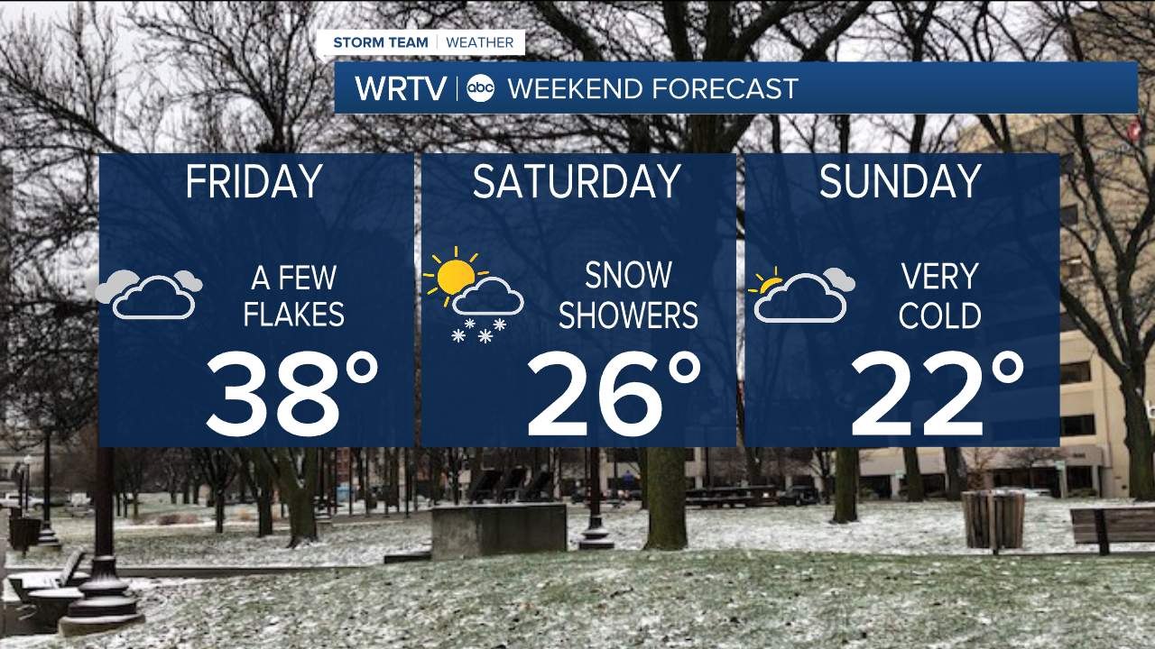
- BRIEFLY ABOVE NORMAL ON FRIDAY
- BITTER COLD RETURNS THIS WEEKEND
After a very chilly day, temperatures will begin to climb during the overnight hours. The warm up will come with a band of light snow moving through the area, which will likely bring some light accumulation and potentially create slick spots for the morning commute.
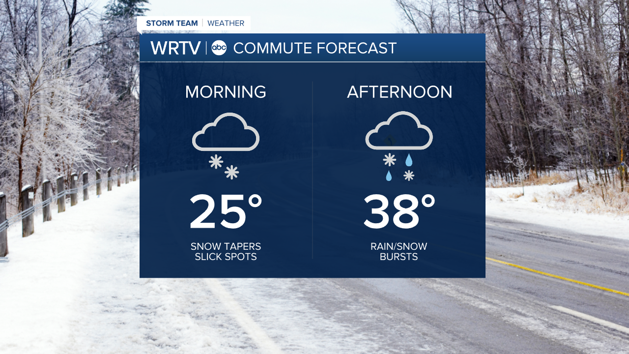
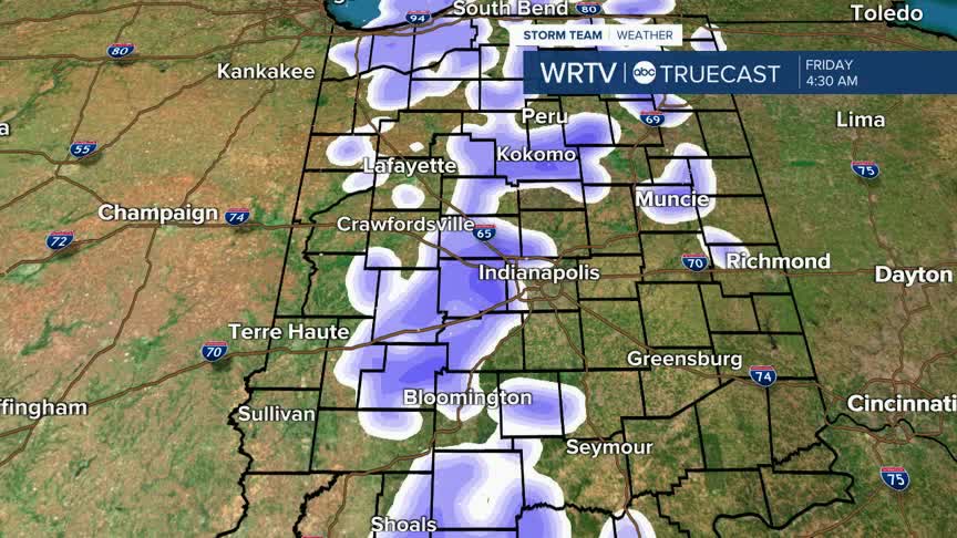
Here is what the radar is expected to look like around 5 a.m. If you are an early riser, you may have to contend with falling snow. However, most of it should be out of the area by the peak of the morning commute. Slick spots, though, will still be possible.

Most of us should see less than an inch of snow, but with the cold ground, whatever does fall will stick. Here are the projected snowfall totals by 8 a.m. Some additional rain and snow showers will be possible in the afternoon and evening. The best chance for additional accumulation will be north of Indy.

Temperatures will be in the low to mid-30s in the afternoon, briefly putting us above normal. We will quickly see those temperatures fall again as we head into and through the weekend.
Indianapolis Weather Forecast:
Overnight: Light snow Low: 21° (but climbing)
Tomorrow: Cloudy with some rain/snow showers High: 38°
Saturday: Mostly cloudy. A few snow showers. High: 26°
Sunday: Partly cloudy. High: 22°
Monday: Bitter cold. Partly cloudy. High: 16°
Indianapolis 7-Day Weather Forecast

