


Headlines
- SHOWERS & STORMS THROUGH EARLY SATURDAY AFTERNOON
- CLOCKS GO AHEAD ONE HOUR SUNDAY MORNING
- SUNDAY IS DRY
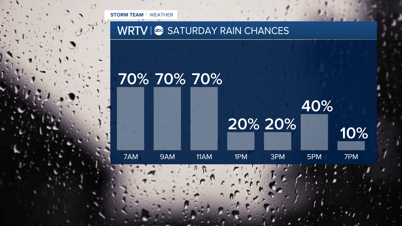
The morning hours for our Saturday look fairly wet, with numerous showers and storms. Heavy rain will again be possible, which is not good news for flooded areas in central Indiana. The severe threat looks fairly low; however, an isolated thunderstorm warning isn't completely out of the question due to some gusty winds. If you have outdoor events in the morning, make sure you stay weather aware and plan on getting wet. We do start to dry out in the afternoon, so the day isn’t a washout. There will likely be one last little band of rain around 5 p.m. when the front moves through. Once that happens, we’re done with the rain.
Temperatures will remain mild, in the upper 60s to low 70s on Saturday.

Don't forget to turn the clock ahead one hour as you go to sleep Saturday night.

The rest of your Sunday is dry with highs around 60°.
Indianapolis Weather Forecast:
Saturday: Stormy morning then drier in the afternoon High: 71°
Sunday: Partly cloudy. High: 61°
Monday: Mostly sunny. High: 72°
Tuesday: Partly cloudy. PM Storms. High: 72°
Indianapolis 7-Day Weather Forecast

