


Headlines
- COOL START TO THE WEEK MONDAY
- WARMING TREND MID-WEEK
- TEMPERATURES CRASH AGAIN FRIDAY
This week, it's another spring temperature rollercoaster in Central Indiana.
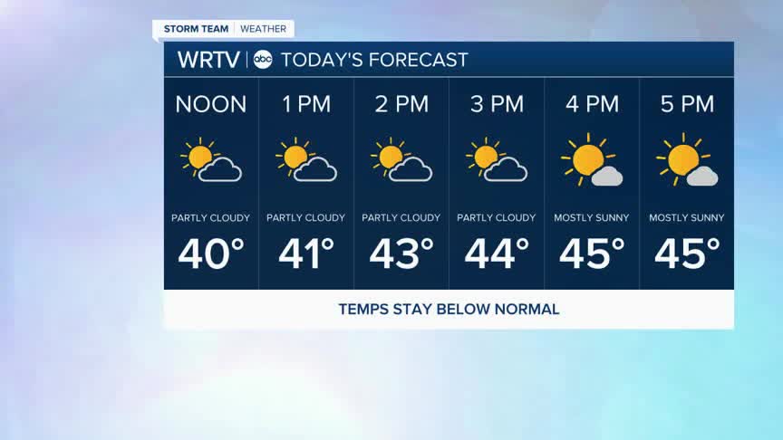
Monday afternoon we will continue to see a mix of clouds and sunshine. Highs are below normal in the mid to upper 40s.

Monday evening you'll want a coat. As the sun sets, temperatures fall again into the 30s.

Tuesday morning it's a cold start, with some temperatures dipping into the 20s. You may want to cover outdoor plants that are susceptible to the cold overnight.

The rest of Tuesday we'll see a mix of clouds and sun. Temperatures are back to normal March level by afternoon, with highs in the mid 50s.

The warming trend continues as we reach 70° on Wednesday. This may be the nicest day of the week. Thursday is warmer, with highs in the upper 70s, but there will be some rain and thunderstorms through part of the day.
Rain showers end early Friday morning. Following this, temperatures crash again to end the week, with highs staying near 50°.
An early peek at the weekend shows temperatures at or slightly below normal with a mix of clouds and sun both Saturday and Sunday.
Indianapolis Weather Forecast:
Today: Clouds clearing. Breezy. High: 48°
Overnight: Partly cloudy and cool. Low: 31°
Tuesday: Partly sunny and milder. High: 56°
Indianapolis 7-Day Weather Forecast

