


Headlines
- SUNNY, MILD AFTERNOON
- WARMING TREND STARTS AGAIN FRIDAY
- SUNDAY RAIN CHANCE
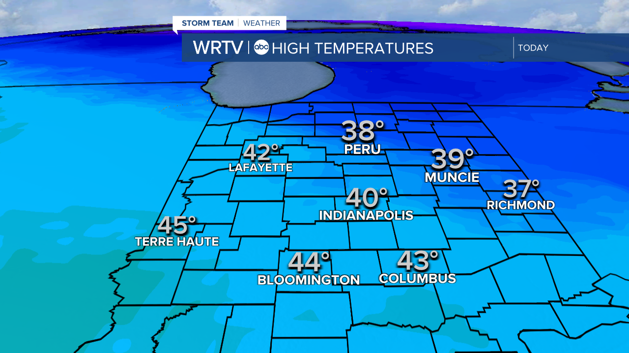
It is a mild February day Wednesday, however, temperatures will feel cooler coming off of a warmer day Tuesday. The day is sunny and a little breezy at times. High temperatures are near normal this afternoon, around 40°, so we'll likely see more snow melting.
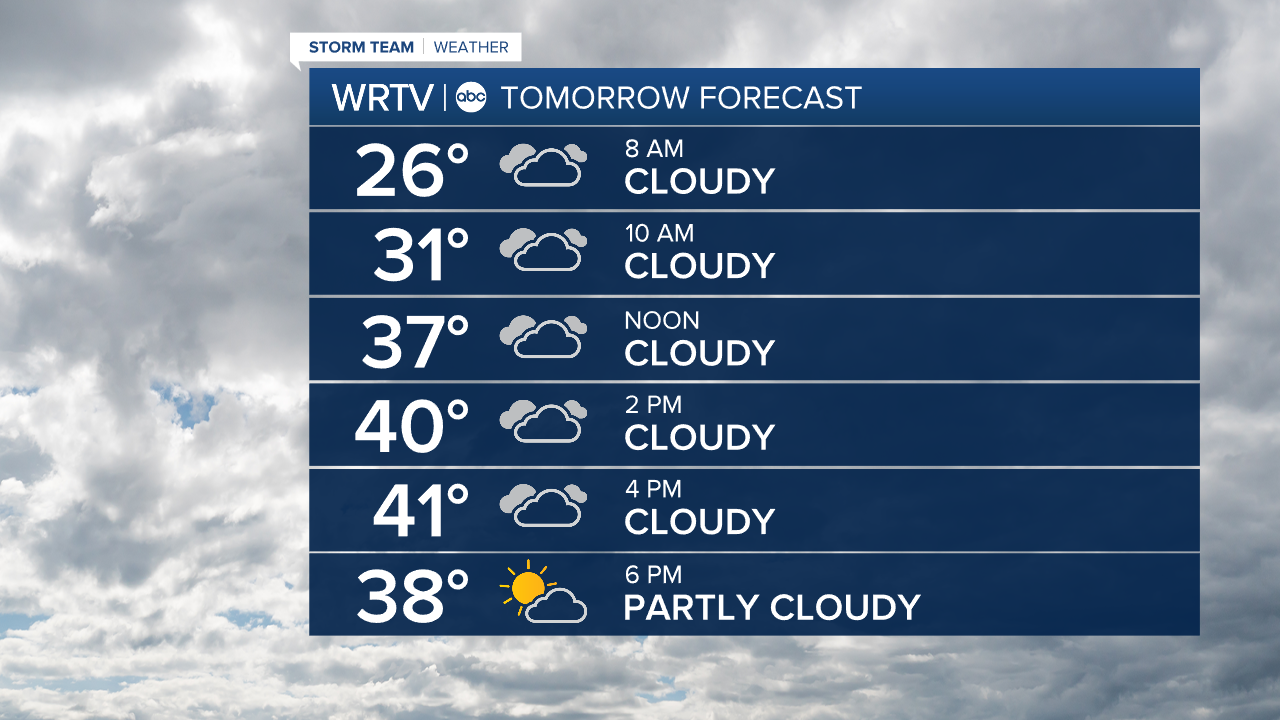
It's another cool start Thursday in the low 20s. There could be some slick spots in the morning. Thursday is cloudier with highs still mild near 40°.
The warming trend starts on Friday. Highs are in the mid to upper 40s to end the week with lots of sunshine.
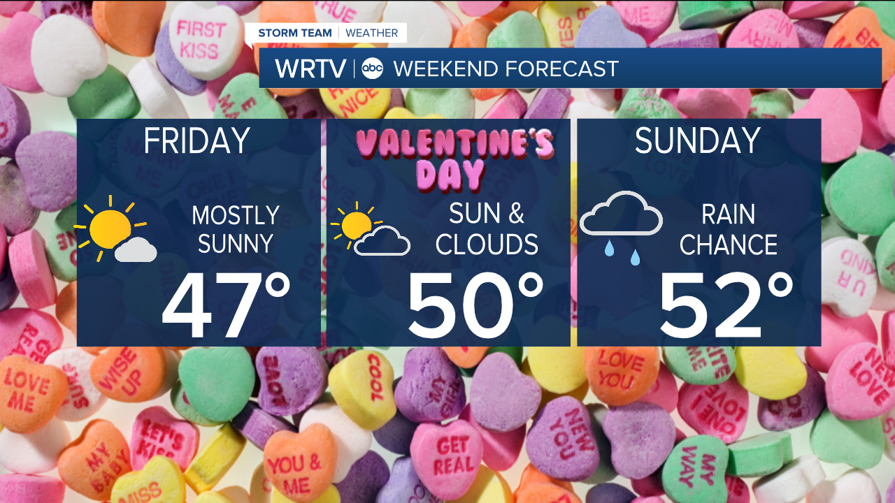
Clouds return on Valentine's Day Saturday as temperatures climb to 50°.
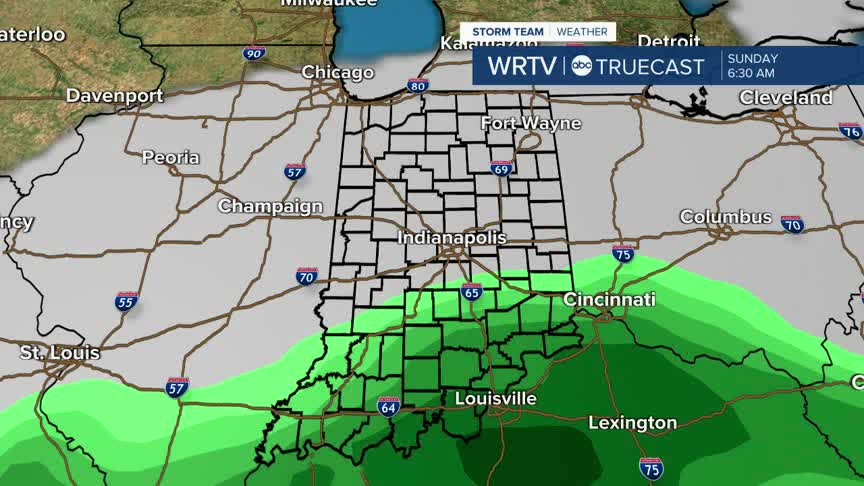
Saturday night, rain moves into the southern portion of the Hoosier state. Rain continues Sunday, and it looks to stay mainly south of Indianapolis. We are still several days out from this, so keep checking back for updates on exact track and timing of this system.
Temperatures will continue to warm through the 50s early next week.
Indianapolis Weather Forecast:
Today: Mostly sunny & mild. High: 40°
Overnight: Becoming cloudier. Slick spots possible. Low: 25°
Thursday: Partly to mostly cloudy. High: 40°
Friday: Mostly sunny & warmer. High: 47°
Indianapolis 7-Day Weather Forecast

