

Headlines
- TEMPERATURES TUMBLE OVER THE WEEKEND
- BITTER COLD ON MLK DAY
A FEW SNOW FLAKES POSSIBLE
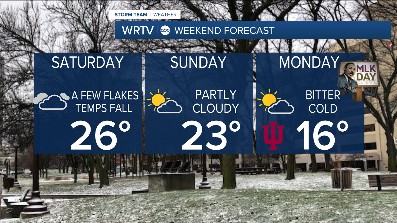
A couple of snow showers may linger into Saturday, but no accumulation is expected. It will be a cold weekend, with temperatures starting in the mid-20s on Saturday and then slowly falling during the day. Wind chill values will be even colder, so bundle up. Don’t be surprised if you see a few flakes overnight and into Saturday, but we are not expecting anything major.

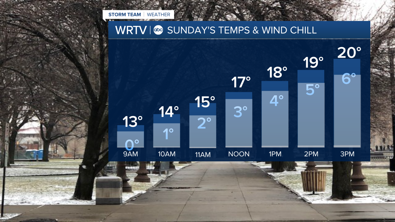
Sunday’s wind chill values will be in the single digits for most of the day. Highs will struggle to get above 20° in many locations. However, we will see a bit more sunshine compared to Saturday, which will be a mostly cloudy day.
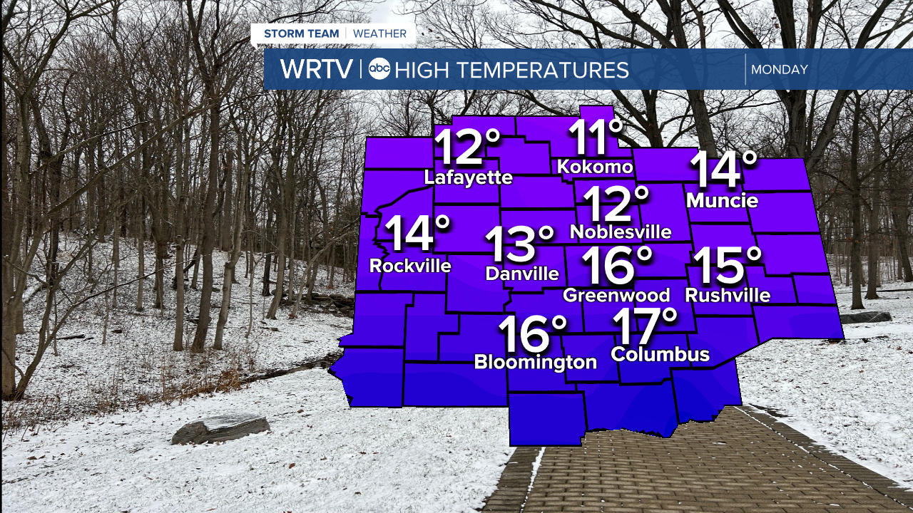
Monday will be the coldest day of the week and the foreseeable future. Highs will only reach the teens, and wind chills will struggle to get above 0°. Try to limit your time outdoors if possible.
We stay chilly next week but not as bitter cold.
Indianapolis Weather Forecast:
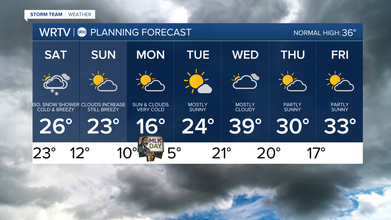
Saturday: Mostly cloudy with flurries High: 26° (But falling)
Sunday: Partly cloudy & breezy. High: 23°
Monday: Bitter cold but sunny. High: 16°
Tuesday: Mostly sunny. High: 24°
Indianapolis 7-Day Weather Forecast