


Headlines
- COLD WEATHER ADVISORY THROUGH TUESDAY AM
- BRIEFLY WARMER ON WEDNESDAY
- BITTER COLD WEEKEND AHEAD
- WATCHING A SOUTHERN STORM SATURDAY
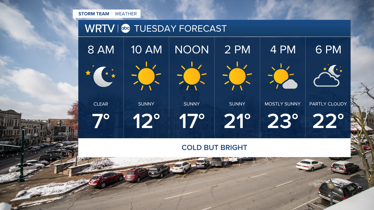
The Cold Weather Advisory continues into the overnight hours until 9am Tuesday morning. Skies will be clear but you will need to bundle up.
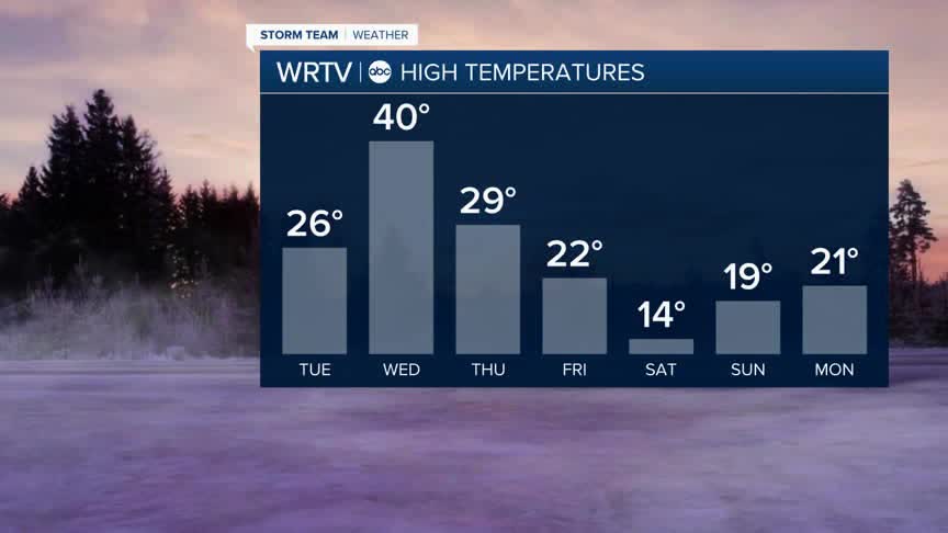
Tuesday comes with lots of sunshine once again. However, it will still be very cold. Not as bad as Monday but highs will only be in the low 20s during the afternoon hours.
Temperatures briefly warm above freezing on Wednesday with maybe a few snow showers but then it is right back down into the frigid weather for the end of the week and the weekend.
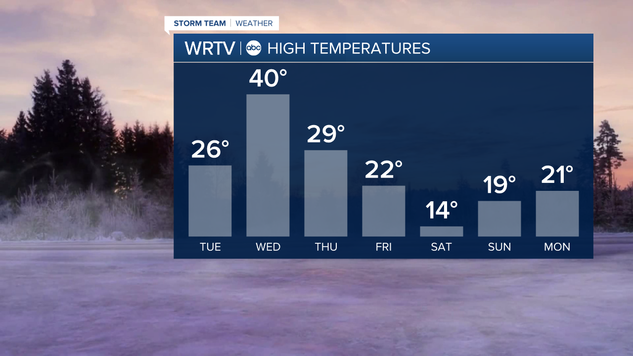
Speaking of the weekend, the cold air will firmly be in place. There will be a big storm moving across the country. Right now it looks like most of the snow will stay to our south. However, some models bring a little bit into southern Indiana on Saturday. We'll have to keep an eye on it but right now the cold looks like the bigger issue.

Indianapolis Weather Forecast:
Overnight: Clear but bitter cold Low: 5°
Tuesday: Mostly sunny. High: 26°
Wednesday: Snow showers possible. Partly cloudy. High: 40°
Thursday: Sun & Clouds. High: 29°
Friday: Mostly cloudy. High: 22°
Indianapolis 7-Day Weather Forecast

