


Headlines
- COLD, SUNNY, DRY FRIDAY
- ACCUMULATING SNOW SATURDAY
- RAIN/SNOW MIX ENDING SUNDAY
An impactful winter storm is approaching Central Indiana. Through the day on Friday, however, the forecast should be quiet and sunny. The day is cold - wind chills in the teens to low 20s are likely through the day.

Any Friday night plans are just as cold. With clear skies, temperatures dip through the 20s. A few clouds may start to develop late tonight, but it stays dry.

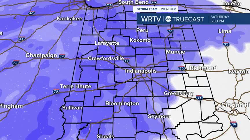
The first snow arrives early Saturday morning, with snow becoming more widespread across the state by midday Saturday. Snow will continue Saturday evening and overnight.

Accumulating snow is likely across the state. The further north you live or travel to, the higher the snow totals will be with this system.

At some point, snow could transition to a rain/snow mix, especially for areas south of Indianapolis. This looks most likely by early Sunday morning.
While precipitation is falling, visibility will be low. Winds gust 25+ mph Saturday into Sunday, which will blow the falling snow around.

Saturday travel will be the most impacted with accumulating snow and low visibility. Road conditions may improve by Sunday, but it will likely still be slow-going for post holiday travel.
Looking ahead - the week should start dry on Monday, but Monday overnight into Tuesday we could see additional snow showers.
Indianapolis Weather Forecast:
Today: Mostly sunny and cold. High: 33°
Overnight: Becoming cloudy. Low: 20°
Saturday: Alert Day: accumulating snow. High: 34°
Sunday: Rain/snow mix early. High: 33°
Indianapolis 7-Day Weather Forecast

