


Headlines
- COLD TEMPERATURES SETTLE IN
- MORE MINOR SNOW CHANCES
- VERY COLD FOR MLK DAY
Temperatures have been dropping ever since early Wednesday morning. Now that the cold air is in place, temperatures will continue to run well below normal, except for a very brief warm-up on Friday. For Thursday, we'll see the return of sunshine, but it will be a cold day from start to finish. Highs will only reach the low to mid 20s across the area. A few flurries are possible as we head into the evening hours.

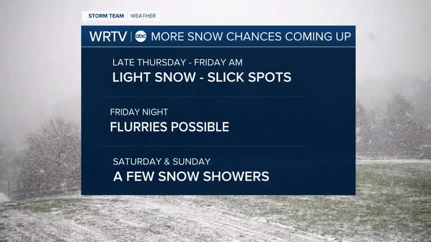
As we look ahead, more chances for snow are in the forecast. All of these will be light snow events. However, reduced visibility and some slick spots will be possible, especially on Friday morning. Over the weekend, a few snow showers are possible, but nothing major is expected.

Once the snow showers move through, Friday will again pull down some very cold air from Canada. This will bring our high temperatures over the weekend into the low to mid 20s, with low temperatures dropping into the teens. That cold air will continue into MLK Day as well, when we might not even get out of the teens.
Wind chill values will make these temperatures feel even colder as we go forward.
Indianapolis Weather Forecast:
Overnight: Partly cloudy. Cold Low: 16°
Thursday: Sun & clouds. Chilly High: 26°
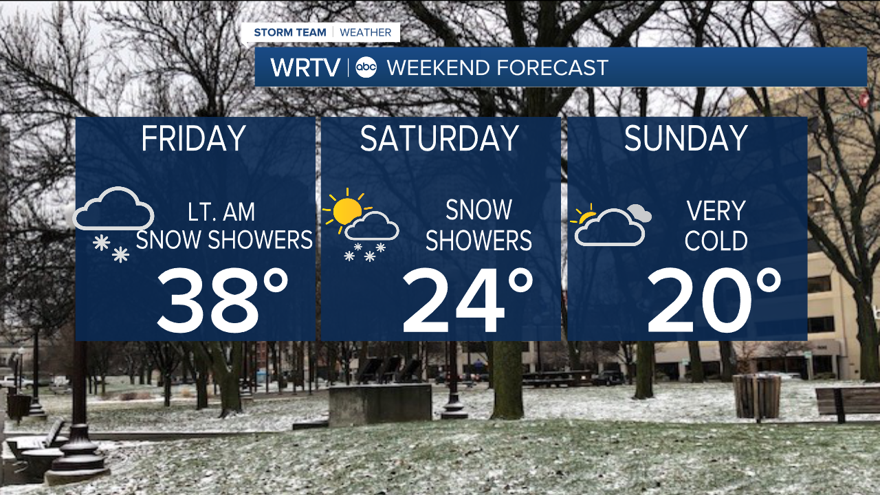
Friday: Snow showers early. Briefly warmer. High:38°
Saturday: Sct. snow showers. High: 24°
Sunday: Partly cloudy. High: 20°
Indianapolis 7-Day Weather Forecast

