


Headlines
- DANGEROUS COLD TUESDAY NIGHT INTO WEDNESDAY MORNING
- TEMPERATURES REMAIN BELOW FREEZING
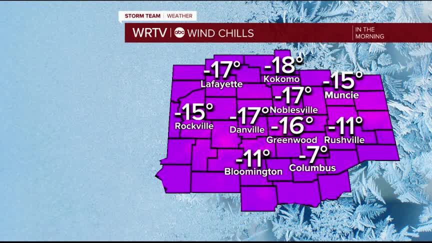
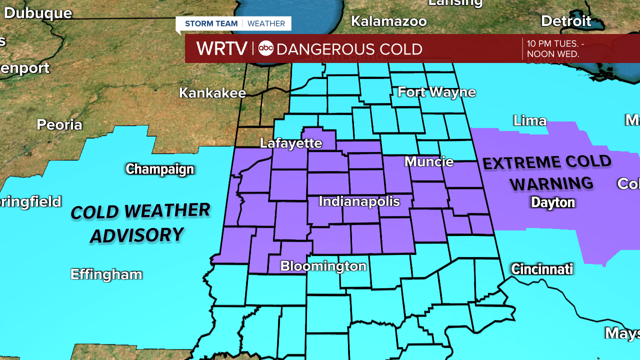
An extreme cold warning is in effect for portions of Central Indiana, with other portions of the state under a cold weather advisory. These alerts last until noon Wednesday. Wind chills -20° to -25° are possible early Wednesday.
Limit your time outdoors, and wear warm, protective layers.
Be prepared that roads will be slick again - which could create slowdowns on the Wednesday morning commute.
Wednesday is very cold, with a mix of clouds and sun. Highs warm into the mid teens by afternoon.

Wind gusts will pick up again midday Wednesday. Similar to Tuesday evening, we could see some blowing/drifting snow, especially in rural areas. This may push snow back into the roads.
There is no real sign of a warm up in the near future. Temperatures stay below freezing through the 7-Day Forecast, although high temperatures warm ever so slightly into the 20s early next week.
We should have a break from snow through the end of the week, however, it does look like some snow showers are possible Sunday night into Monday.
Indianapolis Weather Forecast:
Overnight: Dangerous cold. Low: -6°
Wednesday: Very cold start. Sun & clouds. High: 17°
Thursday: Partly cloudy and still cold. High: 13°
Indianapolis 7-Day Weather Forecast

