


Headlines
- WINDY WITH FALLING TEMPERATURES WEDNESDAY
- RAIN TRANSITIONS TO SNOW
- ACCUMULATING SNOW THURSDAY NIGHT INTO FRIDAY
- EVEN COLDER AIR THIS WEEKEND
Wednesday is a day of change. Temperatures start in the low 40s in the morning, then gradually fall into the mid 30s by afternoon. With wind gusts up to 35 mph through the day, it will feel even cooler. Make sure any yard decorations are secure.

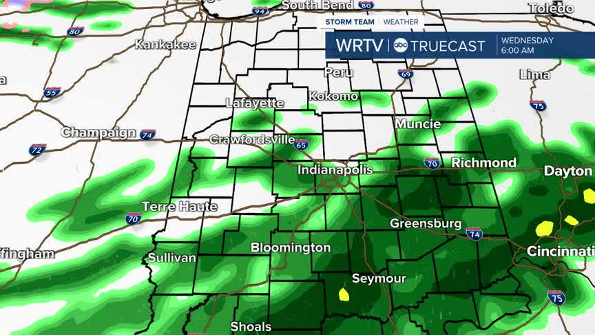
There will be some lingering showers through the day, starting as rain in the morning, then transitioning to a rain/snow mix, and all snow late in the day. Very light or no accumulations are likely.
Temperatures are cooler to end the week. Thursday could bring a few snow showers during the day, but there is a better chance for snow Thursday overnight into Friday morning. A few inches of accumulating snow is likely by early Friday. Plan on a snowy, slow-going Friday morning commute.

Very cold air is here this weekend, with morning temperatures in the single digits. A few flurries are possible Saturday in addition to the cold temperatures.

Indianapolis Weather Forecast:
Overnight: Scattered rain showers. Wind gusts 35 mph. Low: 38°
Wednesday: AM rain showers, PM snow showers. Wind gusts 35 mph. Temperatures falling to mid 30s by afternoon.
Thursday: Partly cloudy. Accumulating snow overnight. High: 31°
Indianapolis 7-Day Weather Forecast

