


Headlines
- AREAS OF FOG TUESDAY MORNING
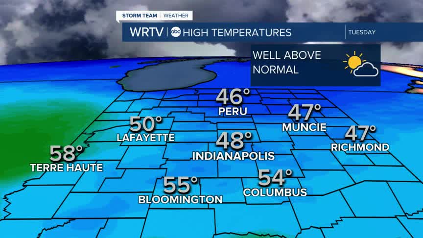
- 50'S FOR SOME ON TUESDAY
- LIGHT WINTRY MIX POSSIBLE LATE THURSDAY
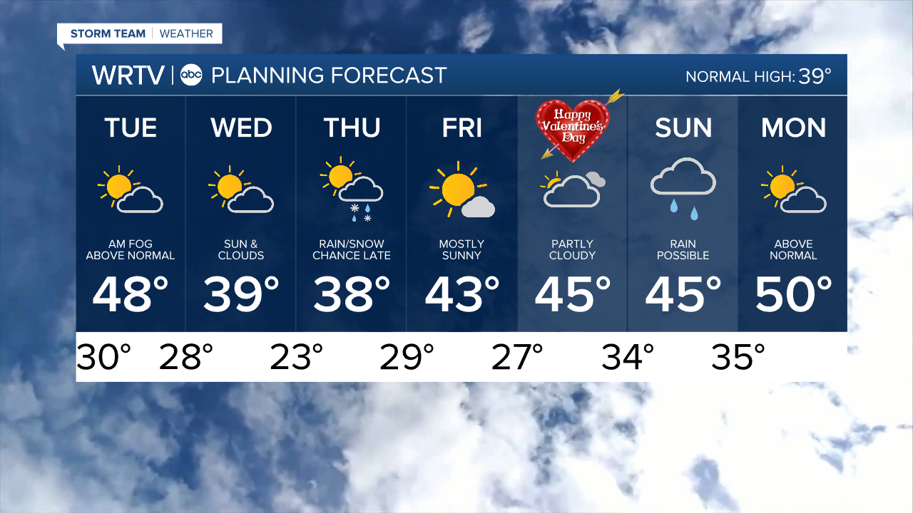
The good news is that we will have a warmer week than what we have been experiencing so far this month. In fact, most of the week will be above normal, except for Thursday, when temperatures will be in the upper 30s. Even that, though, is very close to average. We will put a significant dent in the snowpack on the ground. However, with the warmer temperatures will come melting ice, and some ice jams may be possible on certain rivers, so please be aware of that.

Be on the lookout for fog developing across at least parts of the area tomorrow morning. It might not form until closer to daybreak, when warmer temperatures move in. The warmer air will melt the snow and release moisture into the area, resulting in some fog that could last into the middle of the morning. The best chance for denser fog will be south and west of Indy.

High temperatures will range from the mid-40s to mid-50s on Tuesday, with partly cloudy skies. It has the potential to be the warmest day since January 21.

No major storms are heading our way this week, but a light wintry mix will be possible Thursday night into Friday morning. Then, over the weekend, a bigger storm might bring rain to the area.
Indianapolis Weather Forecast:
Overnight: Partly cloudy. Fog develops Low: 30°
Tuesday: Warmer. Areas of AM Fog. Partly cloudy High: 48°
Wednesday: Sun & Clouds. High: 39°
Thursday: Partly cloudy. Wintry Mix possible late. High: 38°
Friday: Mostly sunny. High: 38°
Indianapolis 7-Day Weather Forecast