


Headlines
- FREEZING FOG POSSIBLE WEDNESDAY MORNING
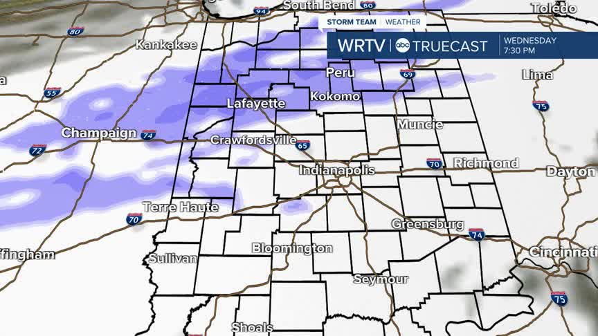
- SNOW CHANCES LATE WEDNESDAY
- TEMPS REMAIN BELOW NORMAL
Winter weather remains in place through this forecast.
Early Wednesday morning, areas of dense fog could develop. Because temperatures are below freezing, any areas with prolonged fog could become a bit icy by early Wednesday. Prepare for a slick spots on the morning commute.

Feels like temperatures are as cold as the single digits early Wednesday.
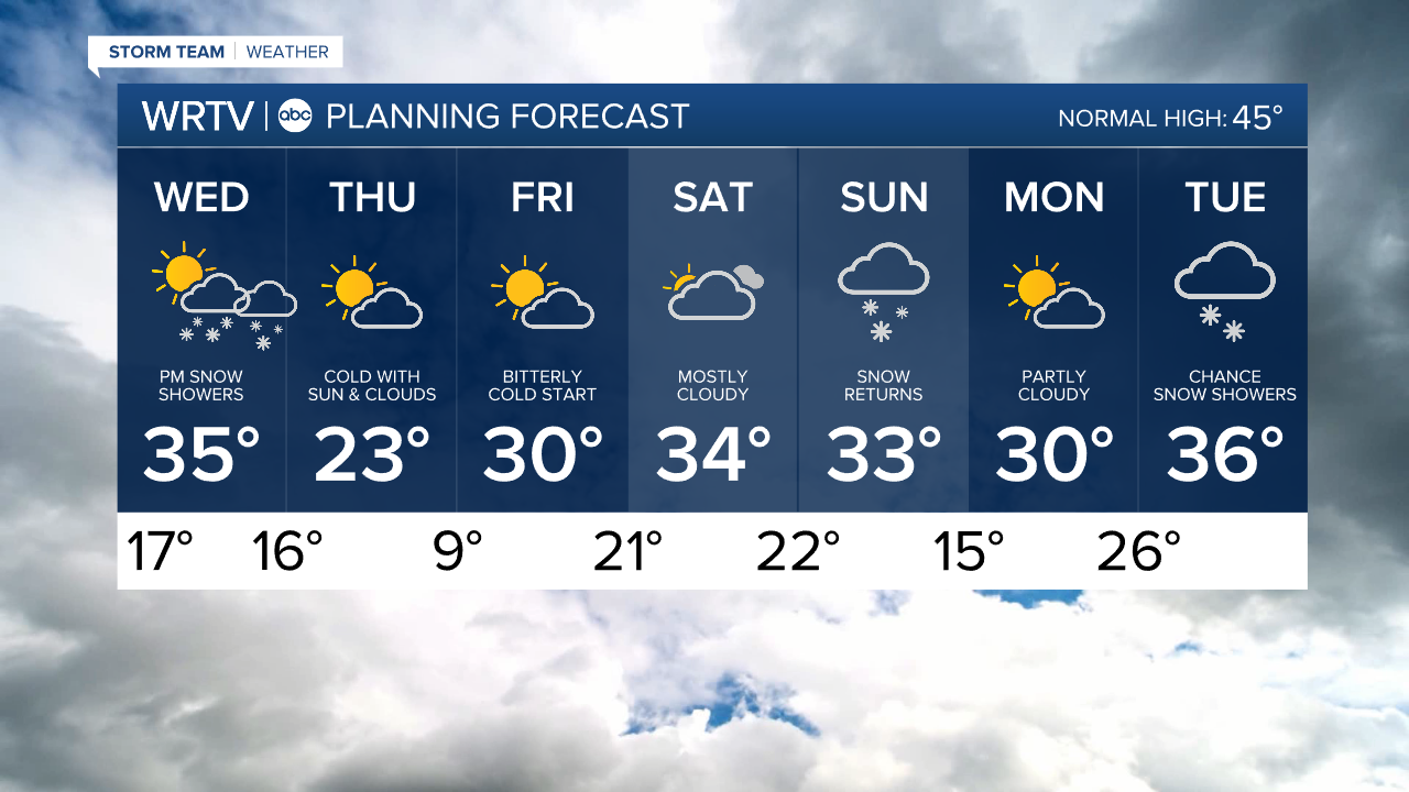
Wednesday is breezy, with wind gusts 15 to 20 mph. There could be a few breaks in the clouds. High temperatures are in the low to mid 30s, but it will feel cooler than that with the wind.

Late on Wednesday, a few snow showers move into the area. These continue Wednesday night, but should end by Thursday morning. Some minor accumulations are possible ahead of the Thursday morning commute. Snow totals should stay less than 1", although many areas will only see trace amounts of new snow.

Prepare for bitterly cold mornings Thursday and Friday, with wind chills in the single digits. Actual temperatures Friday morning may stay in the single digits.
Over the weekend, temperatures won't warm much. Highs should be in the mid 40s for early December, but highs stay in the 30s Saturday and Sunday.
Looking ahead, additional snow is possible on Sunday and on Tuesday, so keep checking back for updates.
Indianapolis Weather Forecast:
Overnight: Areas of fog develop. Freezing fog possible. Low: 17°
Wednesday: AM fog. Breezy. Sun & clouds. PM snow showers. High: 35°
Thursday: Partly cloudy and cold. High: 23°
Indianapolis 7-Day Weather Forecast