

Headlines
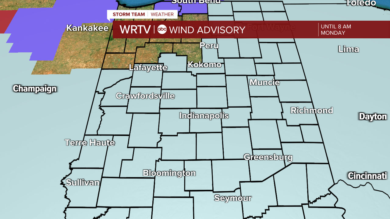
- WIND ADVISORY UNTIL 8 AM MONDAY
- SLICKS SPOTS POSSIBLE WITH REFREEZING
- LIGHT SCATTERED SNOW SHOWERS
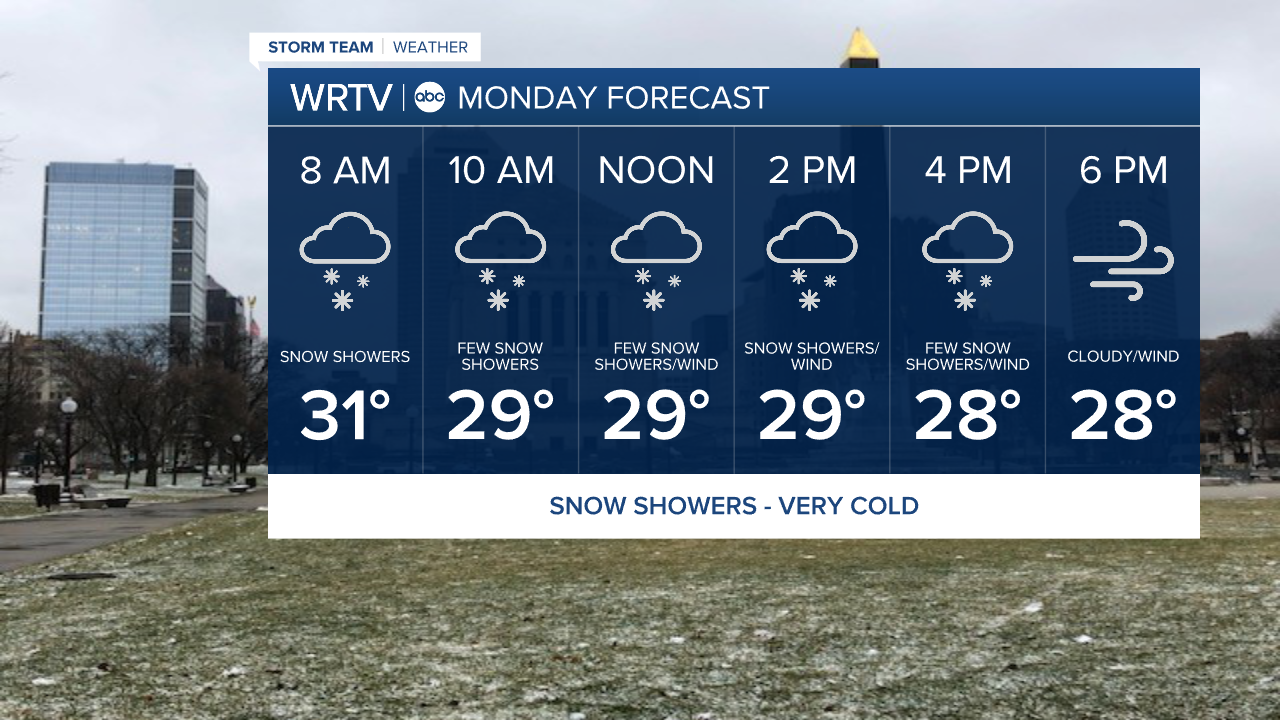
Colder temperatures will quickly overspread the area overnight and will continue to fall throughout the day. We will also be dealing with snow showers off and on throughout the day. While initially the roads will be warm they will eventually cool and snow could stick. It will be spotty though and not widespread. The wind advisory will end at 8 am but it will remain breezy all day and with the cold temps wind chills will be in the teens.
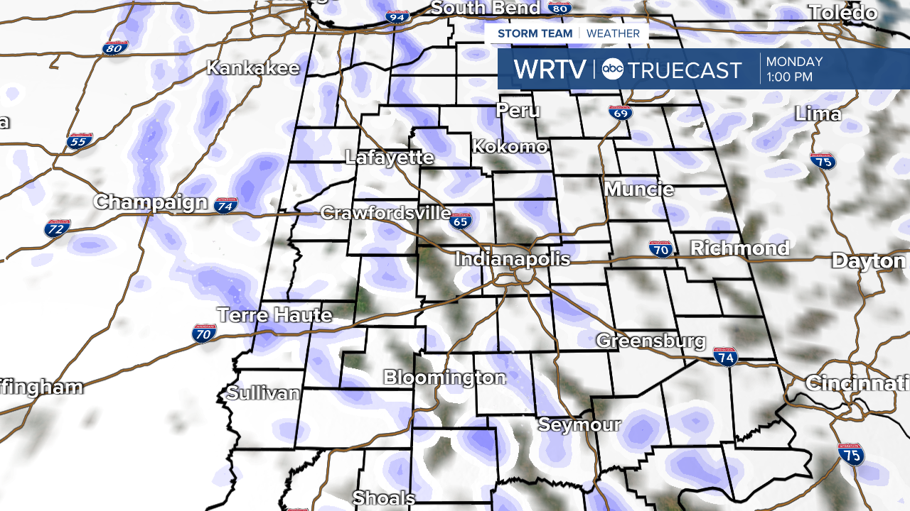
Here is a look at how the snow showers will be distributed. Up to an inch will be possible in some of the more intense ones. Most of that accumulation in on the ground and or elevated surfaces.
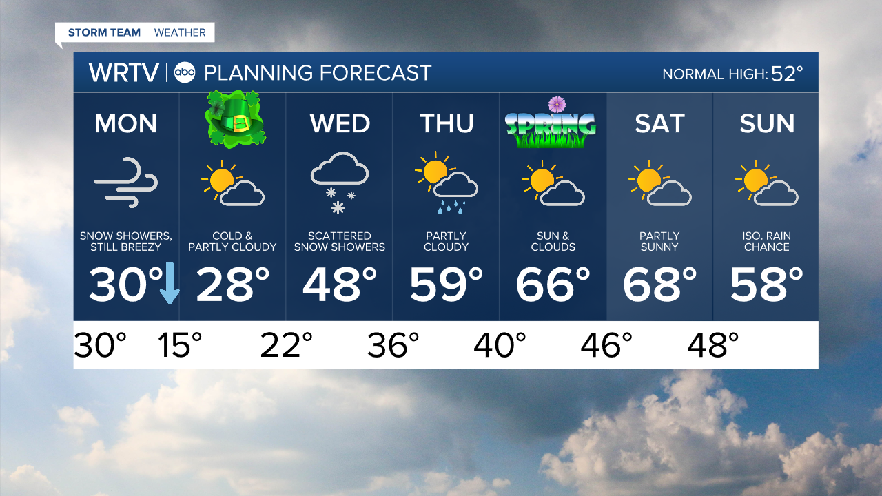
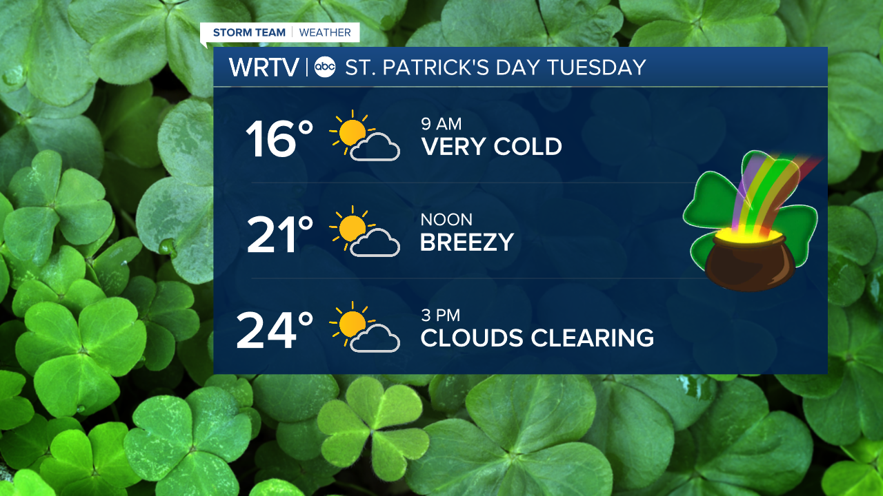
Your St. Patrick's Day will be very cold. We'll start in the teens and then only warm into the 20s for much of the day. It will be dry with some sunshine though.
More snow showers will be possible Wednesday morning but then we warm up nicely the rest of the week and get back to more spring-like weather as you can see in the 7 day planning forecast below.
Indianapolis Weather Forecast:
Overnight: Rain showers to snow showers. Windy Low: Falling temps
Monday: Sct. snow showers. Still windy. High: Falling into the 20s
Tuesday: Partly cloudy & cold. High: 28°
Wednesday: Snow showers early then warmer. High: 48°
Indianapolis 7-Day Weather Forecast