


Headlines
- FOG & DRIZZLE OVERNIGHT
- CLOUDY WEDNESDAY WITH DRIZZLE
- HEAVIER RAIN RETURNS ON FRIDAY
The heavy rain has moved out but dense fog is settling in. It should be more dense south of I-70 than north but give yourself extra time overnight and tomorrow morning. Look for some patchy drizzle as well.

Wednesday will be a rather blah day for us, with lots of clouds and some patchy drizzle at times, especially in the morning. Temperatures will only climb into the upper 40s with all the cloud cover.

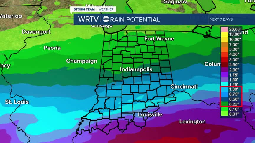
Once we get to late Thursday and Friday, another round of rain will move through. Some areas may once again see over an inch of rain, with totals decreasing as you move north. Either way, it looks to be a fairly wet day for us, so plan ahead if you have any activities

Once the storms pass, a few showers may linger early Saturday morning, but expect more sunshine as the day goes on. Sunday looks to be partly cloudy, with high temperatures in the mid-50s both days

Indianapolis Weather Forecast:
Overnight: Cloudy with areas of drizzle. Low: 43°
Wednesday: Cloudy with areas of drizzle. High: 48°
Thursday: Mostly cloudy - Showers late. High: 56°
Friday: Rain. High: 58°
Saturday: Morning clouds/Shower then partly cloudy. High: 58°
Indianapolis 7-Day Weather Forecast

