


TIPPECANOE COUNTY — The National Weather Service has confirmed two separate EF0 tornadoes in Tippecanoe County from storms on Wednesday evening, June 18.
Have you ever wondered how the National Weather Service determines if a storm is a tornado or straight-line winds?
After a thunderstorm, an emergency management team can request the National Weather Service to send a team to survey the damage.
After Wednesday's storms, that's exactly what Tippecanoe County Emergency Management Agency did.
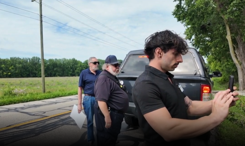
Cody Moore and Andrew White, both part of the National Weather Service office in Indianapolis, were the two meteorologists who completed a storm survey Thursday.

The meteorologists work with the emergency managers throughout their visit.
"They help us navigate the town. We'll usually follow them, because they know where all the damage points are," explained Moore.
Before heading to any damage locations, everyone met in the Emergency Management's office in Lafayette. Here, they explained what they expected to see - lots of trees down. They also mapped out all the locations.
From there, it was a caravan of emergency managers' trucks plus the team from the National Weather Service.

There were between 15 to 20 stops along the route. Each had various damage: trees down, cornstalks blown over and some minor damage to buildings.
When the caravan stopped, each car pulled over along the side of the road. The meteorologists approached the property owner and asked for permission to look at their storm damage. Many of the owners were already outdoors cleaning up damage from the night before.

While walking around the various properties, Moore and White walked around to see the damage up close, then took photos of the damage. They use an app that tracks the location of the damage, where they attach the photos.
The team of meteorologists uses the locations to look back at Radar, where they get an idea of what time the storm went through each location and how intense the storm appeared.
While they are on location, the damage they are assessing is like pieces of a puzzle, ultimately telling them what kind of storm happened and how powerful it was.
"We're looking at the direction of which way trees fell, what's the direction that the damage is," Moore said. "Is it all facing the same way? That can really help us determine if this was straight-line winds or a tornado."

The team also looks at what kind of trees were uprooted or blown over. If they are healthy trees, or if they are older and already rotted. Trees that were not in good health before a storm are more likely to fall during a storm. It takes more powerful wind speeds to knock over a healthy tree.
In addition to looking for damage on buildings and trees, the team can also use cornfields to their advantage.
"We can only see so much from the ground," White said as the emergency managers launched a drone into the air. "This gives us a true 360 image of everything that's going on."
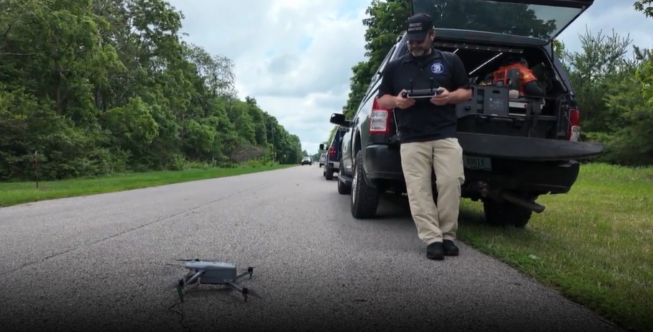

The drone is looking at which direction the corn is lying in the field - all in one direction, or spread into spirals.
"It'll be very concentrated in one spot, with little swirls leading into that," White described of typical tornado tracks in cornfields. "Not really seeing that here."
Throughout the stops, Moore said the outcome wasn't an easy one to call.
"This is actually one of the more difficult ones to do, because we've had a couple signs point towards, oh there could be a circulation here," Moore started. "Some signs in other spots point towards those were straight-line winds."
At the end of the day, Moore and White presented their findings to the entire Indianapolis office.
From all the data, photos, and drone footage, the team determined there were two separate storms, both tornadoes, which meant they did see signs of rotation.

EF0 storms have the slowest wind speeds on the Enhanced Fujita scale. The first storm occurred at 3:02 p.m. and had peak winds of 80 mph. The second tornado was just minutes later at 3:13 p.m. The second storm had peak winds of 75 mph. Both storms only lasted one minute each.
Drone footage was key in determining that the second storm was a tornado, as there were signs of rotation both in the grass and a cornfield when viewed from above.
Storm damage has been reported across other portions of Central Indiana from Wednesday's storms, but Tippecanoe County was the only area the National Weather Service surveyed Thursday.
