


Headlines
- LIGHT SNOW FRIDAY MORNING FOR MOST
- SOME MIXING WILL TAKE PLACE SOUTH
- COLD WEEKEND BUT WARMER NEXT WEEK
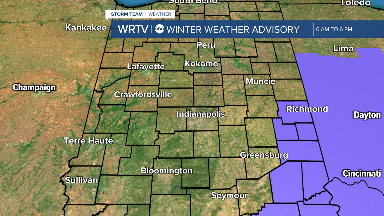
A Winter Weather Advisory is in place for far eastern Indiana tomorrow. While not technically in the advisory, many areas will see some accumulating snow. It won't be a lot, but the timing isn't great, as it will affect the morning commute. Areas south and west of Indy will also have a chance of a little bit of freezing rain mixing in.
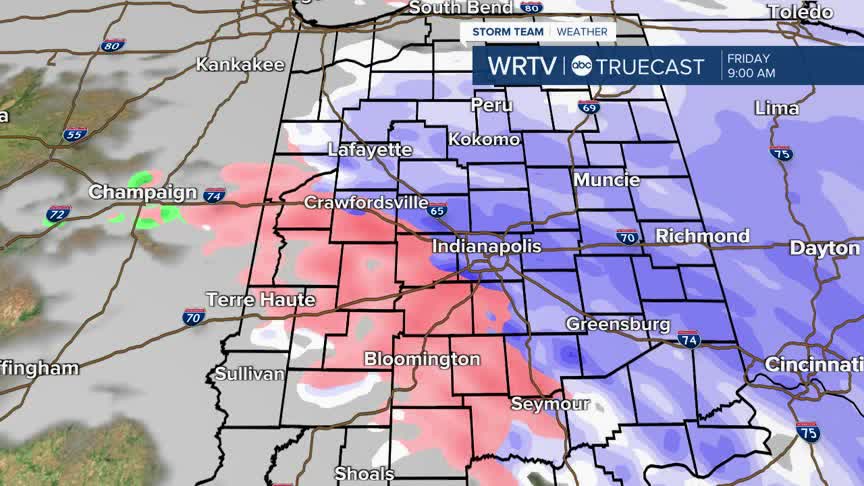
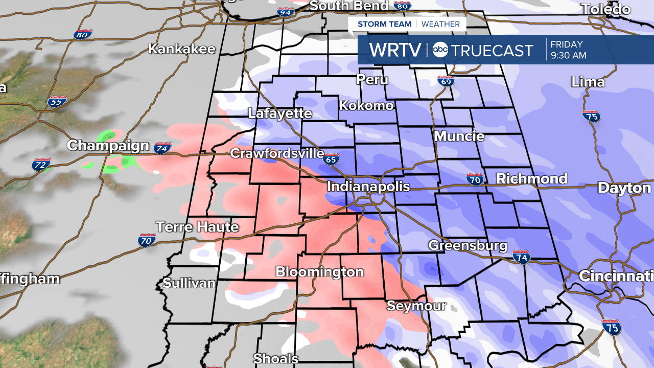
Below is what radar could potentially look like around 9:30 in the morning. Snow will be falling to the north and east, with a mix in western and southern locations.
The morning commute will be the most impacted. Slick roads are likely, even though we aren't going to see a whole lot of snow. By the afternoon, the snow will be gone and temperatures will actually get above freezing.

Snow totals will be 1"-2" along a line from Logansport to Muncie to Richmond and points north. The metro area and areas along I-74 will likely see 1" or less, and further south and west, there will be little to no accumulation. Areas from Greencastle to Bloomington will need to keep an eye out for some light freezing rain or a wintry mix.

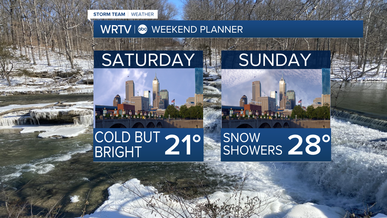
Once this clipper departs, we will get cold again for the weekend, with highs in the 20s on Saturday before it gets a little warmer on Sunday.
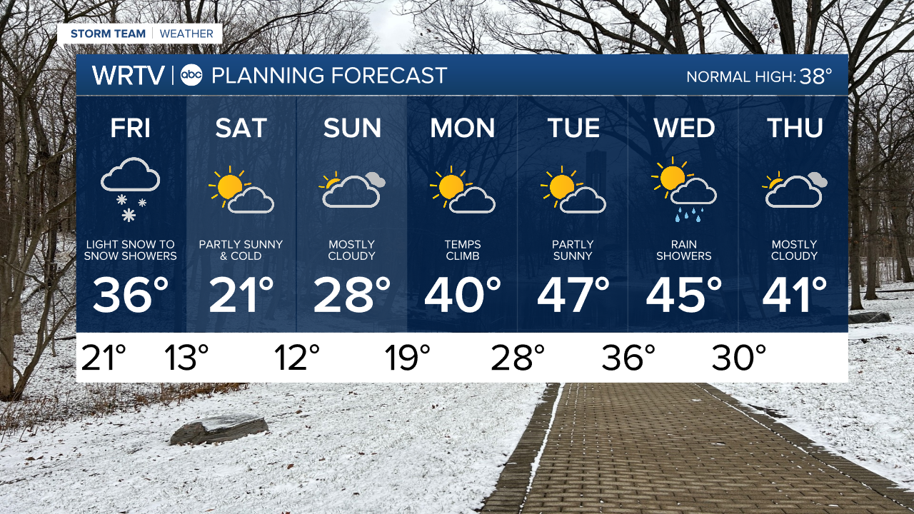
The big warm-up, as you can see below in the 7 Day Planning Forecast, will come next week when we are in the 40s, and some of you may even reach the 50s.
Indianapolis Weather Forecast:
Overnight: Cloudy - Light snow towards daybreak Low: 21°
Friday: Light snow early. Then cloudy High: 36°
Saturday: Partly cloudy. High: 21°
Sunday: Mostly cloudy. High: 28°
Indianapolis 7-Day Weather Forecast