


Headlines
- SCT. SHOWERS OVERNIGHT
- LOCALLY HEAVY RAIN THURSDAY
- VERY HOT & HUMID NEXT WEEK
A stalled front will be a catalyst for more locally heavy rain on Thursday. The heaviest of the rain will be right along the front. Get away from the front and skies will be partly cloudy with warm and muggy conditions.
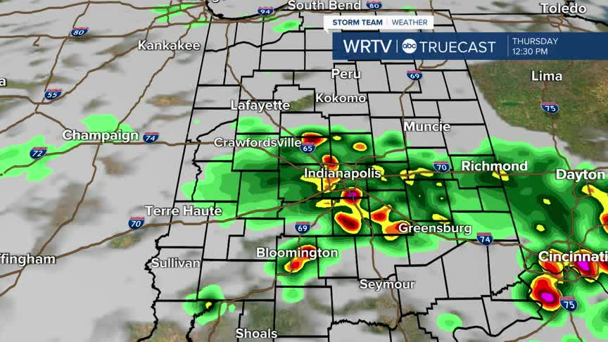
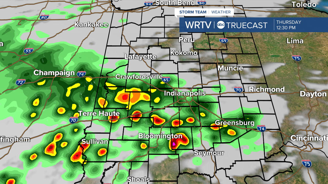
Here is a look at Trucast for tomorrow afternoon. It appears that the heaviest rain will initially be along I-70 before drifting south throughout the afternoon and into the evening hours.
Next week, dangerous heat and humidity return. Dew points will be close to 80° and temperatures into the low 90s. This will put heat index values once again into the low to mid triple digits.
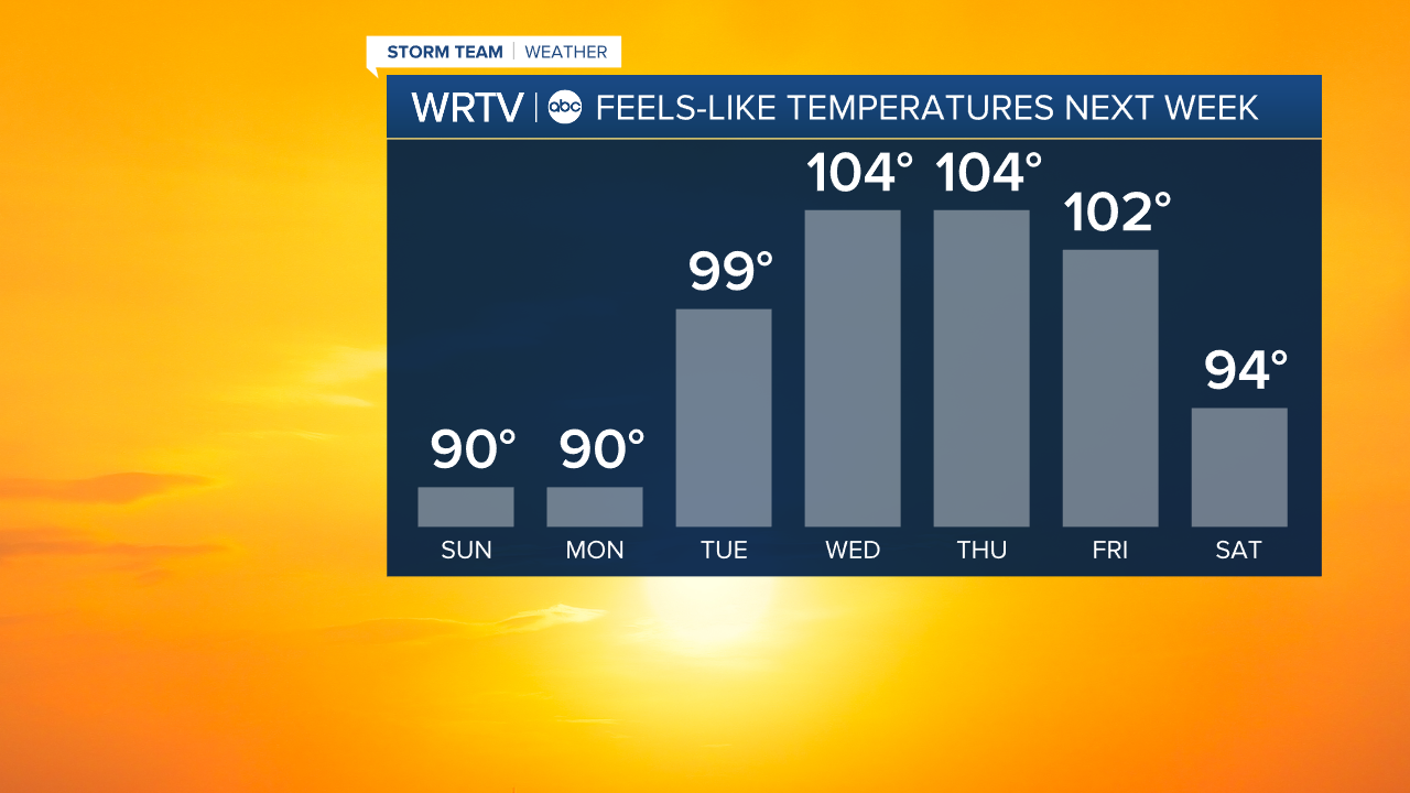
Make sure you plan ahead if you are someone who suffers from heat related issues. Stay with WRTV for all the latest.
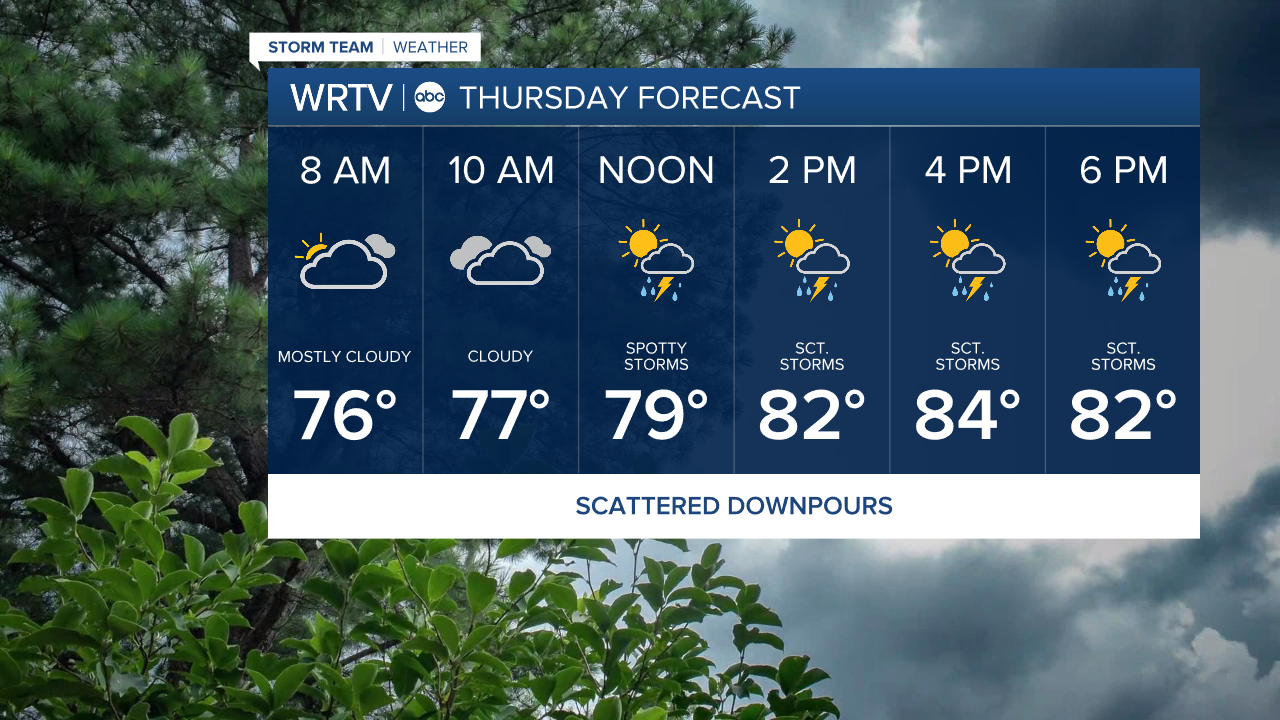
Indianapolis Weather Forecast:
Overnight: Partly cloudy. Sct. storms. Low: 74°
Thursday: Partly cloudy. Locally heavy downpours. High: 84°
Friday: Mostly cloudy. Sct. thunderstorms. High: 84°
Saturday: Partly cloudy. Sct. thunderstorms. High: 85°
Indianapolis 7-Day Weather Forecast

