


Headlines
- COOL MORNING TEMPS - PLEASANT AFTERNOON HIGHS
- RAIN RETURNS ON FRIDAY
- WINTER-CHILL EARLY NEXT WEEK
Afternoon temperatures will run well above normal for most of this week. With that said, overnight lows will still be pretty chilly. Tonight, with mainly clear skies, temperatures will drop to right around the freezing mark.

Despite the cold start, temperatures will climb back into the low to mid 60s by Tuesday afternoon. Expect plenty of sunshine and light winds.

Wednesday will be the warmest day this week, with some locations reaching the 70° mark. However, the warmth will be accompanied by a good amount of wind. Expect wind gusts to exceed 25 mph at times during the afternoon hours.

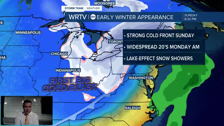
BIG CHANGES are heading our way over the weekend.
Friday will bring fairly widespread rain to the area, along with quite a bit of wind. This is due to a cold front moving through. That cold front will drop temperatures on Saturday into the mid 50s.

A second cold front arrives Saturday night, bringing another round of showers. This will drop us into the 40s on Sunday, and by Monday morning, most of us will have temperatures in the 20s.
Indianapolis Weather Forecast:
Overnight: Mainly clear. Chilly Low: 33°
Tuesday: Mostly sunny. Above normal High: 64°
Wednesday: Mostly sunny. Mild but breezy. High: 69°
Thursday: Partly cloudy - Showers late. High: 59°
Friday: Areas of rain. High: 64°
Indianapolis 7-Day Weather Forecast

