


Headlines
- MILDER TEMPERATURES TUESDAY
- BREEZY TUESDAY, WINDY WEDNESDAY
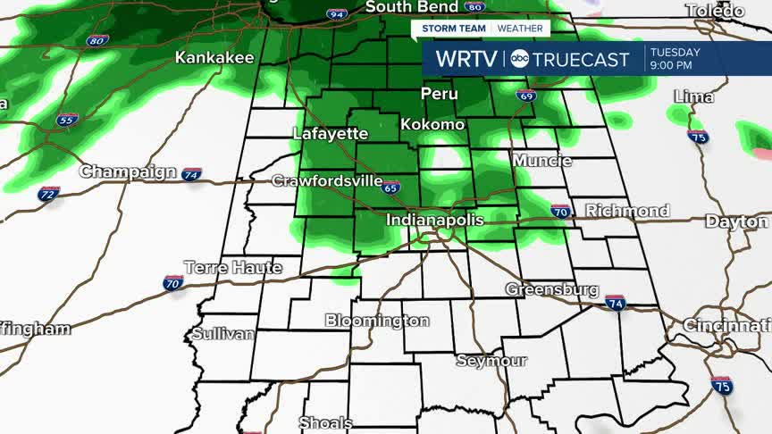
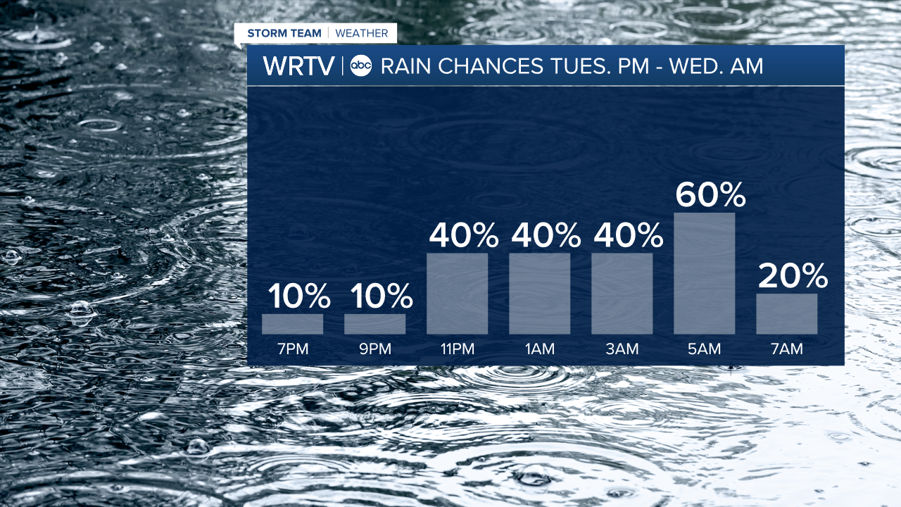
- RAIN CHANCES TUESDAY NIGHT
- RAIN TO SNOW WEDNESDAY
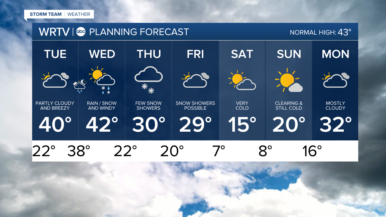
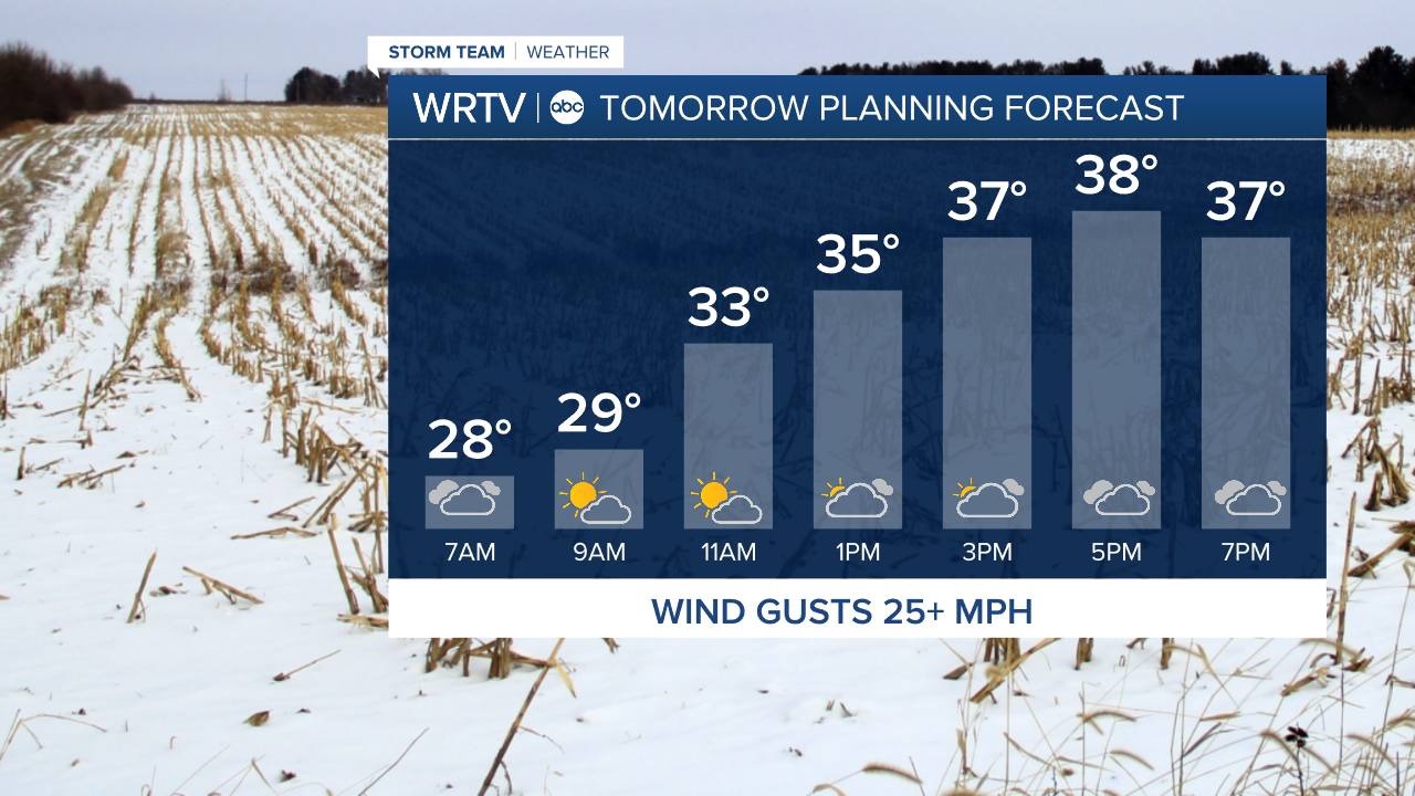
It's another cool start Tuesday morning. The day is a bit warmer than we've been recently, with highs near 40°. It is breezy, with some wind gusts during the day 25 mph. Make sure any holiday decor in your yard is secure.
Tuesday is looking mostly dry, but late Tuesday evening, a few light rain showers begin. These continue Tuesday night into Wednesday.
Wednesday features scattered precipitation, which starts as rain, then turns to a rain/snow mix or possibly all snow late in the day. Precipitation totals will stay low. Temperatures start in the 40s Wednesday morning, then fall to the 30s by afternoon. Wind gusts 30 mph are possible through the day.
There will be some additional snow shower chances Thursday and Friday. Snow accumulations look minor for now.
Very cold weather is on the way by the weekend. Friday night into Saturday morning, plus Saturday night into Sunday morning, will feature single digit temperatures and wind chills at or below zero.

Indianapolis Weather Forecast:
In the morning: Mostly cloudy. Low: 22°
Tuesday: Partly cloudy and milder. Breezy. Rain showers starting late. High: 40°
Wednesday: Rain/snow showers. Windy. Temperatures falling into the 30s by afternoon. High: 42°
Indianapolis 7-Day Weather Forecast