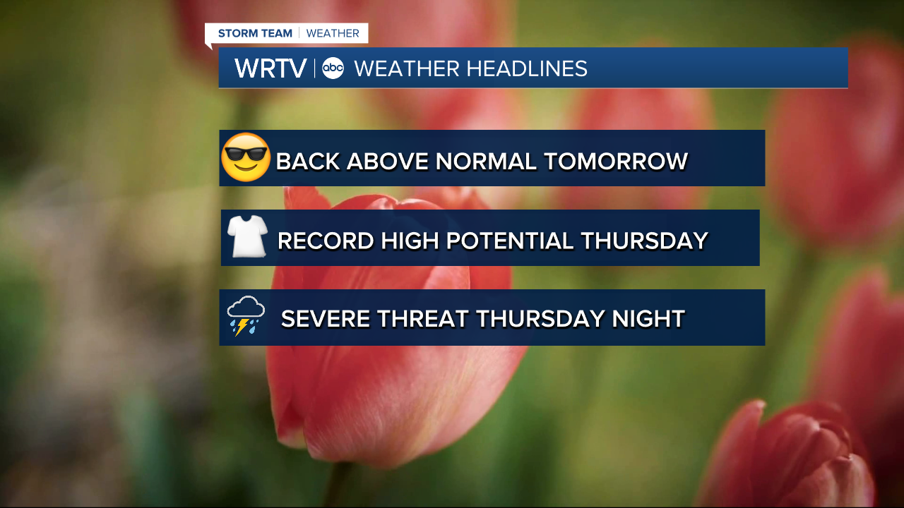


Headlines
- MILD THROUGH THURSDAY
- RECORD TEMPS POSSIBLE THURSDAY AFTERNOON
- SEVERE THREAT LATE THURSDAY INTO FRIDAY AM
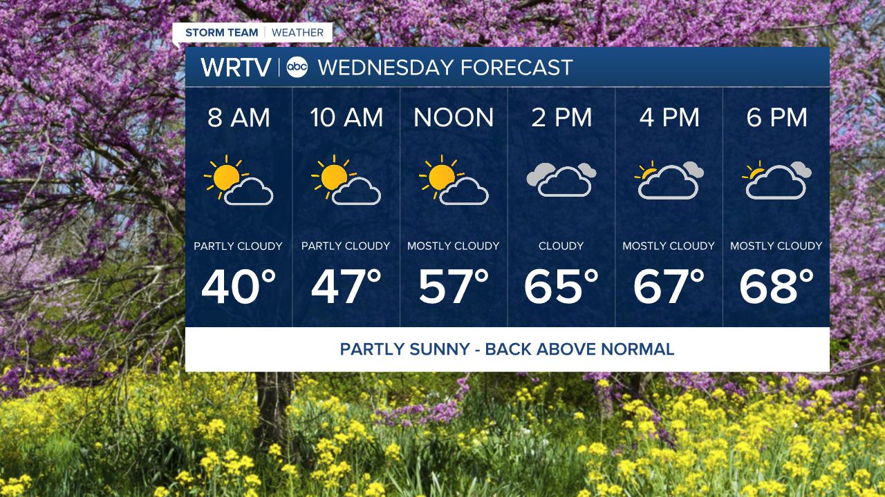
After a cold start to the week yesterday, our temperatures are back on the upswing for the next few days. Overnight tonight, we'll stay above freezing and start our Wednesday around 40°. We will then warm to near 70° in the afternoon, with increasing clouds but dry conditions throughout the day. Get out and enjoy!
After midnight, as warmer air surges in, a few non-severe storms will be possible. They should be gone by the Thursday morning commute.
Once again, we will be on record watch Thursday afternoon. The current record high is 80°, set way back in 1907. We are forecasting a high of 82° in the afternoon, with higher dew points as well. The daytime hours should be just fine. However, after sunset, a cold front will drop south through the area, bringing the chance of severe weather.
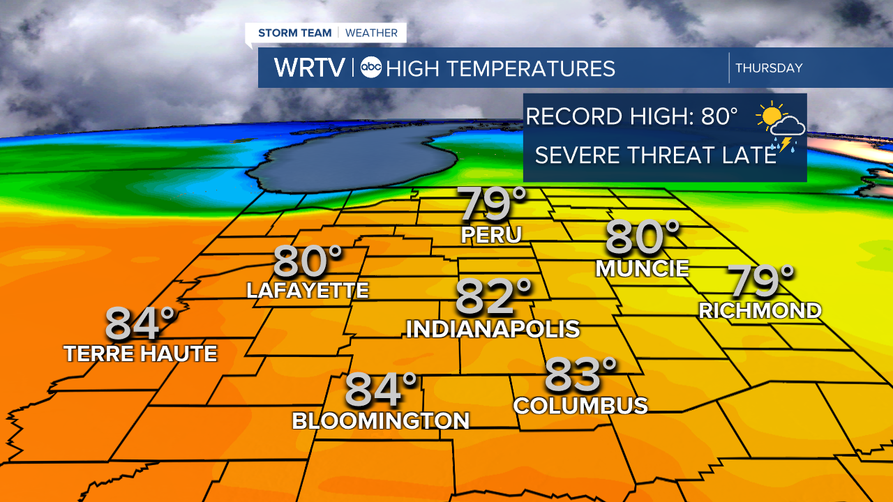
All of central Indiana, and almost the entire state, is under a slight risk (threat level 2 out of 5) for severe storms.
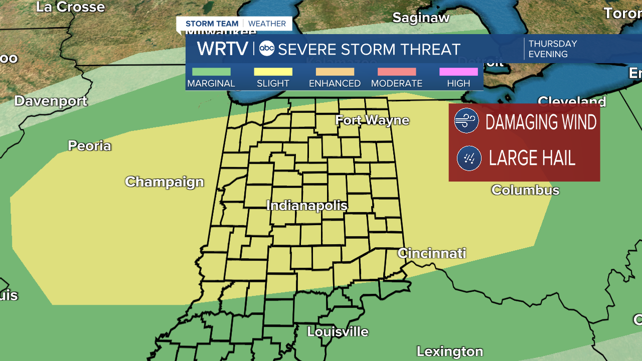
The main threat will be large hail, followed by damaging wind. A quick spin-up tornado isn't completely out of the question, but that threat is low as of now. For most of us, this will be a threat from about 10 p.m. in the north to 3 a.m. in the south. Stay with WRTV for the latest updates, and we'll make sure you are up to date. Until then, enjoy the warmer weather, because it gets briefly chilly again on Friday.
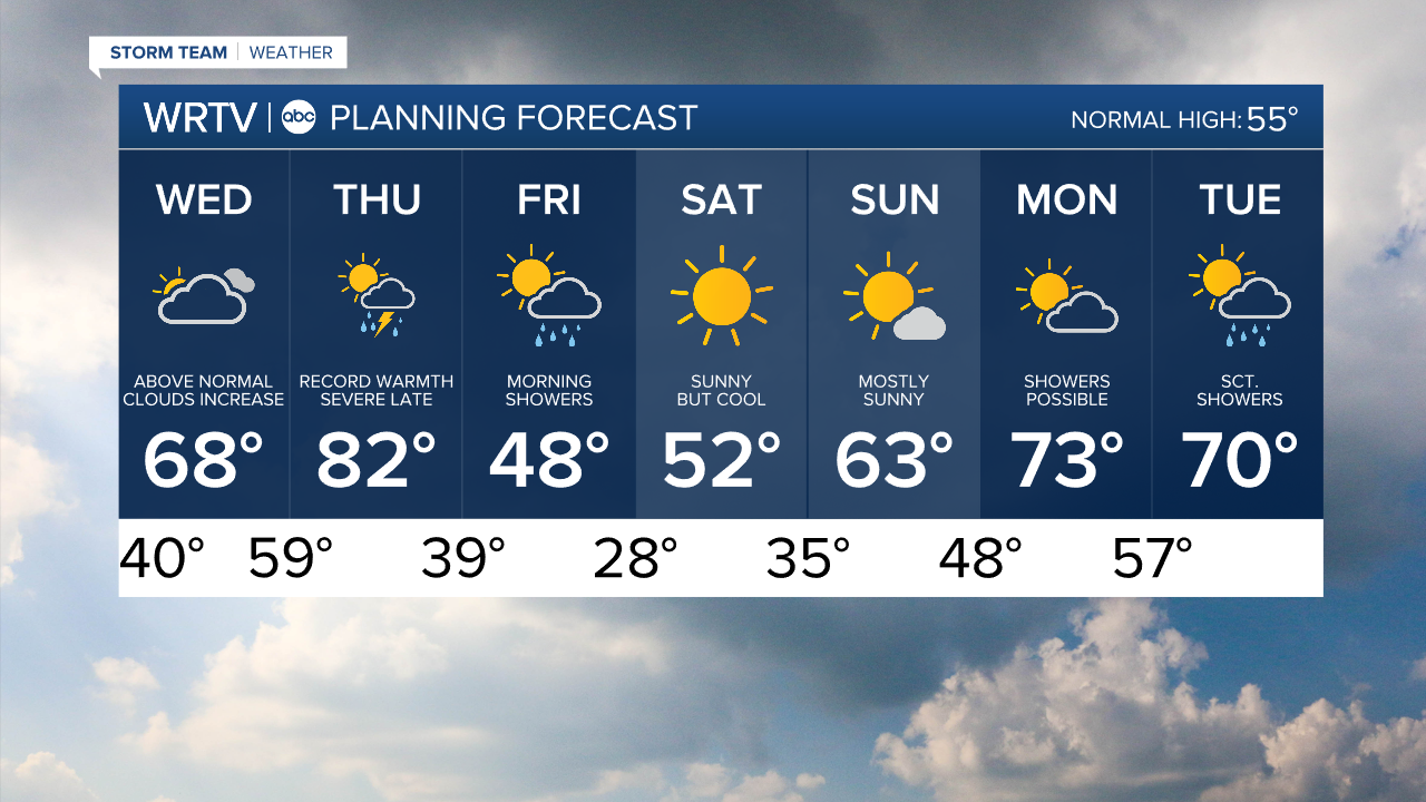
Indianapolis Weather Forecast:
Overnight: Partly cloudy. Low: 40°
Tomorrow: Clouds increase. Above normal High: 68°
Thursday: Partly cloudy & very warm. Severe threat late. High: 82°
Friday: Morning showers. Colder. High: 48°
Saturday: Sunny & cool. High: 52°
Indianapolis 7-Day Weather Forecast