


Headlines
- MILD BUT WINDY WEDNESDAY
- WET AND WINDY FRIDAY
- TUMBLING TEMPS ON SUNDAY
The overall weather pattern will be very active over the next few days, with several cold fronts moving through. Before the first one arrives, look for temperatures on Wednesday to climb into the mid to upper 60s with plenty of sunshine.

As the front arrives, the wind will really start to pick up. Look for gusts in the morning and early afternoon to be around 30 mph before slowly subsiding as we work our way through the day.

Thursday will be fairly quiet before another front brings rain to the area on Friday. That will be the wettest day, with possibly a few rumbles of thunder. Severe weather isn't expected, though. Highs will still be in the low to mid-60s.

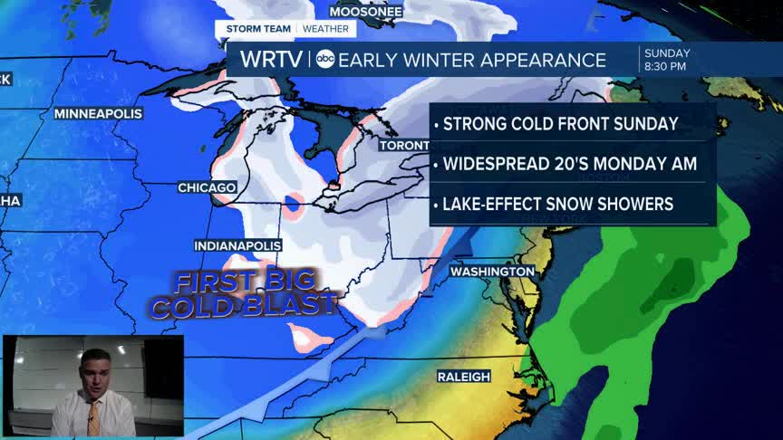
Saturday will be dry but breezy before the final and strongest cold front moves through at night. Another round of showers will be possible, along with falling temperatures. Highs on Sunday will occur just after midnight, then drop into the mid-40s and eventually the 30s by the afternoon and evening hours, with some lingering chances of rain.

Look for temperatures in the 20s to start both Monday and Tuesday mornings. Some snowflakes will also be possible on Sunday and Monday, mainly in northern locations.
Indianapolis Weather Forecast:
Overnight: Partly cloudy Low: 50°
Wednesday: Mild but windy. Partly cloudy High: 69°
Thursday: Mostly sunny. High: 58°
Friday: Areas of rain. Windy. High: 64°
Saturday: Partly cloudy. High: 67°
Indianapolis 7-Day Weather Forecast

