


Headlines
- RAIN TAPERS WEDNESDAY AFTERNOON
- MORE RAIN THURSDAY NIGHT INTO FRIDAY
- TEMPERATURES KEEP WARMING
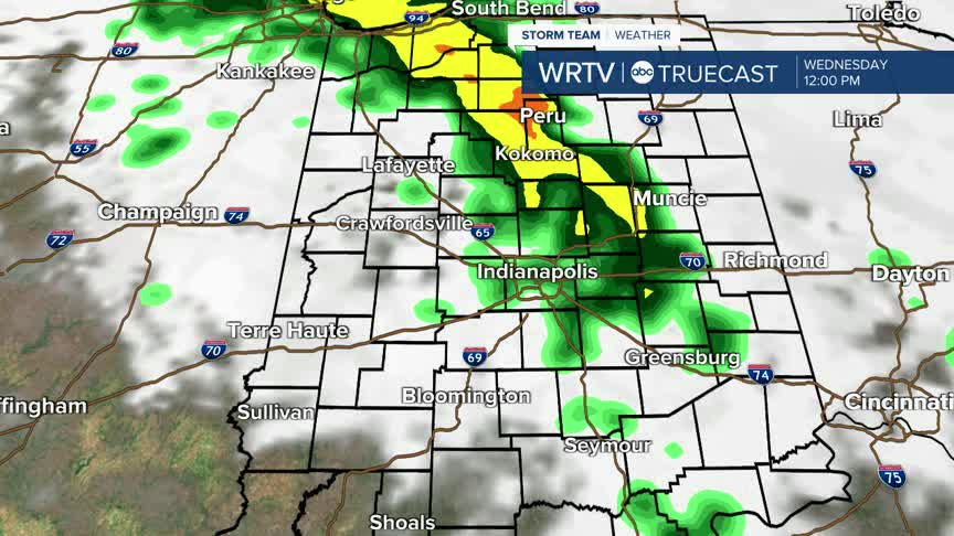
This afternoon, there could be a few lingering rain showers, but the bulk of the rain exits just after the lunch hour. Late in the evening, some clouds may begin to clear.

Temperatures will cool into the low 50s by Thursday morning. Thursday is partly cloudy with mainly dry weather. Highs are in the low 70s tomorrow. Clouds form again in the evening, and we might start to see a few isolated showers late.

The next round of rain is likely Thursday night into Friday. Showers and a few thunderstorms are most likely Friday morning, although a few showers could linger into the second half of the day.

A few additional showers are possible on Saturday or Sunday, but neither day should be a washout. Temperatures are warmer by the weekend, but we will continue to warm through the 80s with mainly dry weather next week.
Indianapolis Weather Forecast:
Today: Scattered showers. High: 70°
Overnight: Some clouds clearing. Low: 55°
Thursday: Partly cloudy. Isolated shower possible. High: 74°
Friday: Scattered showers. Thunderstorm possible. High: 73°
Indianapolis 7-Day Weather Forecast

