


Headlines
- BURSTS OF SNOW FRIDAY EVENING
- TEMPERATURES FALL AGAIN THIS WEEKEND
- BITTERLY COLD EARLY NEXT WEEK
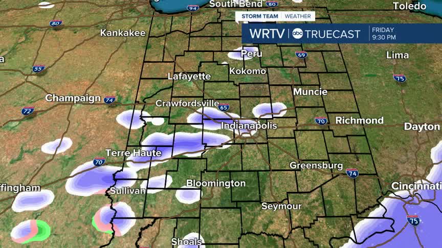
Some scattered snow showers are passing through the area. Snow is mostly light, but at times, there will be quick bursts of heavier snow, which will lower visibility. Outside of the day, it is cool and cloudy, with feels like temperatures in the 20s.

Wind out of the south today will warm us above freezing. Some areas south of Indianapolis could actually climb near 40°.

More snow is possible during your Friday evening plans. This could again include quick bursts of heavier snow, so be careful as you're driving tonight. Snow will continue into the overnight hours.

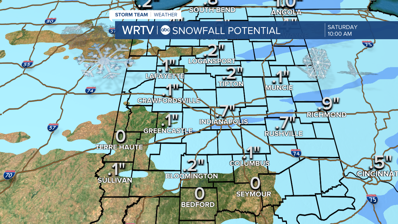
A few flurries linger into early Saturday. Snow totals from Friday night into Saturday will remain low.
Following the snow, temperatures fall from the upper 20s Saturday morning to the low 20s Saturday afternoon.
Sunday is cold with highs in the low 20s and a mix of clouds and sun.
The sunshine lingers into Monday and Tuesday, but this will lower temperatures even more. Highs will stay in the teens for MLK Day Monday, so plan appropriately for the holiday if you plan to be outdoors.
Indianapolis Weather Forecast:
Today: Cloudy with scattered snow showers. High: 38°
Overnight: Scattered snow showers. Low: 25°
Saturday: Few flurries. PM temperatures falling. High: 28°
Sunday: Sun & clouds. Colder. High: 22°
Indianapolis 7-Day Weather Forecast

