


Headlines
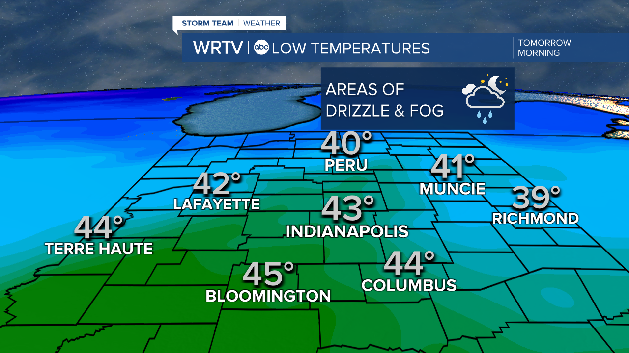
- PATCHY DRIZZLE & FOG OVERNIGHT
- WARMING TREND
- MILD BUT WITH A TEMPERATURE SPREAD CHRISTMAS
Overnight, skies will be cloudy, and some light drizzle and fog are possible. Temperatures will remain well above freezing, so you won’t have any issues with wintry conditions.
Some of that drizzle and fog could linger into the start of Tuesday, but overall, it will turn into a decent day with sunshine in the afternoon and temperatures well above normal, reaching the low to mid 50s.

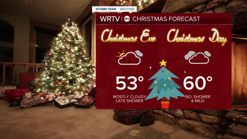
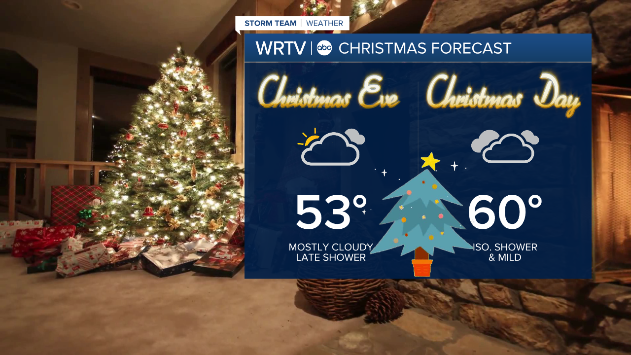
Looking ahead to Christmas Eve and Christmas Day, it will remain mild, with near-record temperatures expected on Christmas. Indianapolis should be around 60°, though there will likely be a significant temperature spread from north to south, with cooler highs in the 50s to the north and mid to upper 60s to the south.
Temperatures will get much colder again to start next week.
Indianapolis Weather Forecast:
Overnight: Patchy drizzle and fog. Low: 43°
Tomorrow: Morning clouds then clearing. High: 56°
Christmas Eve: Mostly cloudy. High: 53°
Christmas Day: Mostly cloudy - Spot shower. High" 60°
Indianapolis 7-Day Weather Forecast

